 Spaces for People
Get project news
Do you want to receive an email when news items are posted?
Latest news
Stay involved in the discussion. Keep up to date with the latest news and share it with your fellow community members.
Help shape future transport plans in East Renfrewshire
Help shape future transport plans in East Renfrewshire
To support development of East Renfrewshire’s new Local Transport Strategy we have launched a transport survey to gather community feedback to help shape future transport priorities.
The survey will be open until 19 July and can be accessed at www.smartsurvey.co.uk/s/er-transport
For further information and details on how to get in touch please visit www.eastrenfrewshire.gov.uk/Local-Transport-Strategy
Spaces for People findings published
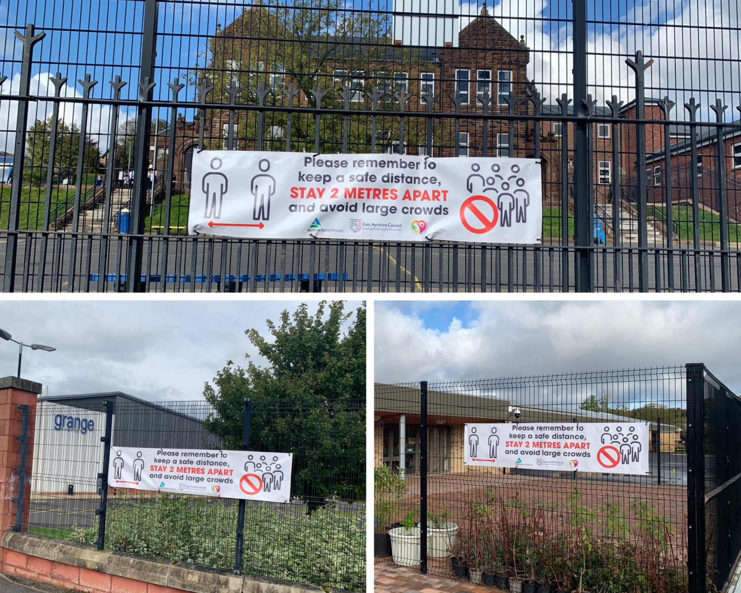
In 2020, East Renfrewshire Council (ERC) began consultation on our Spaces for People projects - temporary pilot measures intended to enhance road safety, encourage use of sustainable modes of transport, and make it easier to maintain social distancing during the COVID-19 pandemic.
We have now concluded our analysis of comments and findings arising from these measures. Reports summarising the consultation feedback, and the outcomes of monitoring and evaluation, are available for viewing near the bottom of the following pages:
A77 - Early removal of light segregation
We thank everyone who took part for your contributions.
Next steps
We have recently submitted applications to the Sustrans Places for Everyone programme which, if successful, will support development of a business case and initial concept designs for:
We encourage everyone with an interest in the future of the A77 to subscribe to updates from the dedicated A77 Active Corridor website. We will post news updates and further consultation opportunities there as the project progresses. ERC will publicise opportunities to comment on our proposals for the other projects in due course.
Early removal of A77 light segregation - views wanted
ERC seeking views from the community and stakeholders regarding early removal of temporary light segregation from Ayr Road and Fenwick Road.
You can find out more information and share your views by visiting https://erspacesforpeople.commonplace.is/proposals/views-on-early-removal-of-a-77-light-segregation
ERC Response to Ayr Road Petition
East Renfrewshire Council have recently responded to Action Against East Renfrewshire Bollards Petition seeking removal of temporary light segregation on Ayr Road.
You can read the council's response to the Petition and points raised here .
Please note East Renfrewshire Council continue to welcome feedback on Spaces for People measures direct by email (spacesforpeople@eastrenfrewshire.gov.uk) or by phone (via Customer First) on 0141 577 3001.
Last chance to comment on Spaces for People measures
Consultation on East Renfrewshire’s Spaces for People temporary measures is set to close on Tuesday 30 November 2021. No comments on this website will be accepted after this date. This will allow time to analyse all feedback received on the projects prior to final evaluation and reporting in Spring 2022.
It is widely recognised that the Commonplace feedback hub has been key to helping communities share their views and we thank everyone who has taken the time to submit feedback so far.
Within the next couple of weeks, the team will post updates on the individual project pages regarding the status of the projects and the likely next steps. This information will remain visible after the closing date to help support future community conversations. In the meantime, we would invite you to make any final comments you may have on the measures by clicking the links below:
Fenwick Road pop up cycle lanes
Academy Road ‘school street’ pilot
Davieland Road traffic calming measures
Please note that, even after these pages have been closed to comments, we will continue to welcome feedback by email to spacesforpeople@eastrenfrewshire.gov.uk or by phone (via Customer First) on 0141 577 3001.
Design Feedback page launched for Phase 2 of Ayr Road 'Spaces for People' upgrade
Following the initial phase of the Ayr Road Response Measures, which saw the creation of 'pop-up' cycle lane segregation and the reduction of the speed limit to 30mph, East Renfrewshire Council will now progress further changes as part of Phase 2 of the project.
While the temporary traffic management used in Phase 1 brought some benefits, offering a degree of separation between people cycling and driving, we know that the frequency with which the cones were moved sometimes presented a hazard to all road users. We will therefore replace the cones with fixed, purpose-built, 'light segregation' units, as shown below:
We have heard community feedback about the difficulty of car parking, so we will add new parking bays at two locations along Ayr Road - near Mearns Cross and Ashtree Grove. We will also address concerns about congestion by reinstating two general traffic lanes on the approach to Mearns Cross.
We recognise that some issues, such as junction safety and parking along the corridor generally, cannot be adequately addressed through a temporary infrastructure programme. Consequently, we are also seeking the community's early views on longer-term priorities for Ayr Road.
To view full details of the scheme, please follow this link: https://erspacesforpeople.commonplace.is/proposals/a-77-ayr-road-phase-2
‘School Street’ trial set to launch at Giffnock Primary
The scheme will start on June 7 and will operate on a temporary basis for a maximum of 18 months. During this time, the council will seek feedback from parents, pupils and residents to determine whether the scheme should be made permanent, modified or withdrawn.
Exemptions to restrictions will apply to include permit and blue badge holders as well as emergency vehicles. Residents within affected streets will be provided with a permit as well as instructions on how to apply for additional permits, if necessary.
Environment convener, Councillor Alan Lafferty, said: “The introduction of a ‘School Street’ at Giffnock Primary School will help make the journey to and from school safer, healthier and more pleasant for our pupils and their families.
"The scheme will encourage more active travel to school through walking, cycling and scooting which can be a long term benefit for physical and mental health. It will also help to reduce congestion and pollution at the school gates.
"For those parents who still need to drive, we ask that you park away from the school and walk for the last five or ten minutes of the journey.
"I look forward to seeing this pilot getting started and if successful we will consider if there are other schools which could also benefit from a similar scheme being introduced in the future.”
The scheme will continually be reviewed and the public are encouraged to submit feedback through the Spaces for People Commonplace platform: https://erspacesforpeople.commonplace.is/proposals/academy-road-giffnock
Design Feedback page launched for Davieland Road 'Spaces for People' proposals
East Renfrewshire Council will be trialling temporary changes on Davieland Road, Giffnock, to make it easier and safer for people to move around https://erspacesforpeople.commonplace.is/proposals/davieland-road
Initial changes will see adjustments to the road layout, including the formation of a temporary pavement between the Boathouse entrance to Rouken Glen Park and Rouken Glen Road.
The Council will also be seeking public feedback on additional temporary measures for the street and identifying the community’s priorities for permanent measures they would like to see implemented in the future.
Taken forward with Sustrans ‘Spaces for People’ funding, measures will seek to address ongoing road safety and accessibility concerns on this busy section of road which runs alongside the popular Rouken Glen Park. Initial works will commence on 31 May 2021 for approximately two weeks and operate on a temporary basis.
Environment Convener, Councillor Alan Lafferty, said: “Rouken Glen Park is one of the most popular places to visit in East Renfrewshire and the area is always very busy so I am pleased to hear that Spaces for People measures are being introduced on Davieland Road.
“ As this road layout is changing, I must encourage drivers to slow down when driving along Davieland Road, look out for other drivers and road users, and be mindful of people on foot and bikes, as well as other drivers pulling out of parking spaces. "
“ If you’re parking on Davieland Road, do so considerately – don’t block junctions, driveways, the cycle lane or park on double yellow lines. If there are no car parking spaces near the Boathouse then please park a short distance away instead and walk the last five minutes. By doing so we can help to make the road safer for everyone whilst continuing to promote an active and healthy lifestyle .”
Temporary Cycle Route segregation to be installed on Grassyards Road, Kilmarnock
The existing advisory cycle lanes on Grassyards Road (between Strawberry Bank Road and Sutherland Drive) will soon be improved through the installation of “soft segregation” measures.
Wands and kerb units will be installed to prevent vehicles from entering the cycle lane, either to pass other vehicles or to park. These soft segregation measures help to reduce feelings of vulnerability, particularly amongst novice cyclists and those who only cycle occasionally, increasing their confidence and therefore supporting cycling as a method of active travel.
The measures will be in place for up to 18 months with installation programmed for April 2021.
After installation it will be possible to give feedback on the scheme using an online questionnaire and monitoring will be undertaken to help to determine if the measures could be made permanent.
Plans showing the proposals have been uploaded here .
School Streets Trials Agreed
Catrine Primary and St Sophia’s Primary in Galston will be the first schools in East Ayrshire to take part in a School Streets trial.
The schools were chosen based on feedback received through our online engagement about temporary school streets at various locations in East Ayrshire.
The trials will last a minimum of four weeks, with a start date dependent on the lifting of Scottish Government restrictions that have closed schools.
Further information on the proposals can be found at www.east-ayrshire.gov.uk/schoolstreets
The scheme will be monitored during the third week of the trial period, with questionnaires being posted to residents, circulated to all parents/carers via the school app, and promoted to the wider community via the community council, ward members and social media channels.
Updates on these projects will be available on East Ayrshire Council’s website.
East Renfrewshire Spaces for People; Update & statement on Giffnock Town Centre
Happy New Year to all East Renfrewshire Spaces for People subscribers
The development and rollout of the various COVID vaccines is the best possible news to herald in the New Year. Although the end is now in sight, restrictions have to continue until the virus is under control. It is important you continue to adhere to the rules , stay local and keep yourself and others safe. Where possible you should consider walking, wheeling or cycling, if you can, to reduce pressure on the road network and on public transport where capacity will be limited.
Spaces for People Update
The main news update is the ongoing development of the initial phase of the A77 Ayr Road and Fenwick Road South ‘Bike & Roll’ corridor. Although works were originally scheduled to be complete late December, bad weather (first lots of rain, then a cold snap) has delayed efforts. We would be keen to continue to gather your views as this will ultimately help shape measures in the week and months ahead.
For further information regarding the status of A77 road corridor plans you can find out more information contained within our A77 Briefing Note November 2020 originally issued to local stakeholders.
Giffnock Town Centre
We are aware of discussion in the community regarding the removal of all on street car parking and the reallocation of road space within Giffnock Town Centre. There are no proposals in the pipeline to do this, however upon reviewing the engagement material on our Commonplace site we note that the indicative June 2020 draft plans for Fenwick Road included Giffnock Town Centre. This document was added to the site in error and represented initial potential considerations which will not be taken forward. The document will be replaced and we apologise for any confusion.
For background, the June 2020 plans were developed alongside a series of emergency proposals for key areas across East Renfrewshire following the first ‘lockdown’. Physical distancing was, and remains, one of the main tools available to reduce virus transmission and a key element of East Renfrewshire’s Transport Response to COVID . Early on however it was recognised that series of challenges and uncertainties meant that progressing a programme of significant road space reallocation in Giffnock and elsewhere was not feasible, proportional nor necessarily welcome during a time of business uncertainty.
Since July 2020 ERC have instead promoted a ‘ Safe streets healthy businesses ’ approach to help facilitate safe trading during COVID. This included provisions to empower businesses to encourage creative ways to reimagine public space to support safe trading and enable distancing within the public realm.
The rationale for this decision was the emergence of evidence indicating relative risk levels to COVID exposure. With appropriate controls and observing safety guidelines, being outdoors and shopping are generally classed as low risk activities with higher risk activities, such congregating within an busy indoor environment like a restaurant or coffee shop, requiring greater levels of control to minimise contagion. Along the main thoroughfare of Giffnock Town Centre footway widths are generally sufficient to enable distancing between people, however, an increase in congestion or an increase in outdoor trading may be problematic. We believe therefore that the approach adopted provides both flexibility and support to enable businesses to seek solutions that works best for their particular circumstances.
Please note, the council and partners continue to offer support and advice on how to stay safe during COVID and are committed to support local businesses during a very challenging time.
Looking to the future
Over the coming months we will continue to investigate opportunities for temporary measures along the A77 road corridor through Newton Mearns and Giffnock into Glasgow. This includes opportunities for temporary bus and cycle priority measures and traffic signal optimisation. More information on this can be found within our Bus Priority Rapid Development Fund Briefing Note December 2020 . We recognise however that areas such Town Centres - with a range of competing demands on finite road space – any proposals, even temporary, require further assessment, analysis and engagement and this is what we intend to do.
Over the coming months we will continue to assess the feasibility of delivering further Spaces for People and other proposals across East Renfrewshire. These include, amongst other priorities, the viability of further pop up Bike & Roll Corridors, how best to facilitate a functional and inclusive active travel network, ‘school street’ trials and further incentives to encourage residents to shop locally.
Please subscribe to our News page to receive notification on plans in your area.
Although there is an immediate need to limit virus transmission to save lives, we also need to look into the future and how best to support a sustainable transition and recovery from COVID. As part of this we want to make it easier and safer for people to move around by supporting a choice of local journey options. As well as improving accessibility to and from key destinations, this is essential in terms of sustainable management of the road network, safeguarding public health, protecting the environment and supporting the revitalisation of local town and neighbourhood centres hit hard by COVID. Many of us have already changed our transport habits by walking, cycling and wheeling more for exercise and/or essential journeys. How we move around more sustainably will be a pressing question over the next decade. Decisions taken now and the key lessons learnt will ultimately help inform what future and more permanent measures might look like into the future.
A77 Ayr Road - Temporary 30mph Speed Limit
As part of temporary traffic measures for Ayr Road, East Renfrewshire Council recently published details of the Temporary Traffic Regulation Order which authorises a reduction of the speed limit from 40mph to 30mph. This will come into effect 5 January 2021 and will remain for a maximum period of up to 18 months on a trial basis to allow for ongoing monitoring and evaluation. Further information is available at https://www.tellmescotland.gov.uk/notices/east-renfrewshire/traffic/00000240664
Since the launch of the Ayr Road Design Feedback page we have had over 170 comments on the temporary "bike and roll" corridor proposal currently in development. Your feedback is important as it helps enable a better understanding of how these measures impact residents and road users, what changes may be necessary and what measures will look like moving forward.

Best wishes and hope you have COVID safe Christmas and New Year.
ERC COVID Transport Response Team
Works underway on the Fenwick Road (South) Bike & Roll Corridor
Works on the Fenwick Road (south) section of the A77 Bike & Roll corridor commenced on Tuesday 15 December and will be complete by the end of the week.
We anticipate that following works there will be a period of time for everyone to become accustomed to the new layout. As part of the A77 trial we will continue to monitor any impacts arising from the changes. We would also encourage you to keep sharing your views on the scheme via our Design Feedback page .
Your views are important and will allow us to better understand how these changes affect you.
Best wishes and hope you have COVID safe Christmas and New Year.
ERC COVID Transport Response Team
Spaces for People East Renfrewshire - latest news
You can read our latest News Update on our Spaces for People Design Feedback Hub erspacesforpeople.commonplace.is/news
We will no longer be posting news and updates via our Heatmap News site, so please make sure you subscribe to our new page for future updates.
Thanks
Works Commence on A77 Ayr Road “Bike & Roll” Corridor & FAQs
Installation works have started on the initial phase of A77 Ayr Road Spaces for People proposal. We anticipate the ‘lining & signing’ and cone/bollard placement to take around two weeks. During this time there may be a chance of minor disruption and we thank you for your patience and understanding.
We are keen to understand how these measures impact residents and road users, and what changes may be necessary. Your feedback is important as it will ultimately decide the future design approach and what measures will look like moving forward.
We would therefore encourage you to continue sharing your views via the A77 Ayr Road design feedback page , our dedicated mailbox (spacesforpeople@eastrenfrewshire.gov.uk) and the East Renfrewshire Council social media via Twitter and Facebook . This will help allow adjustments to be made and feed into future design development.
If you have a visual impairment or require additional support or assistance please contact Customer First on 0141 577 3001 and they can feedback comments or put you in touch with the project team.
Following the launch of the Commonplace design feedback page and resident notification we have received a lot of questions regarding the design, approach being adopted as well as concerns regarding the impacts of these changes. We have therefore pulled together a list of Frequently Asked Questions which we hope may be of some assistance - A77 Ayr Road Frequently Asked Questions
A77 ‘Pop up bike & roll lanes’ & new Commonplace Hub
As previously reported the last few months have been both busy and challenging with a lot of work going on behind the scenes to maintain services while also planning our response to, and how we transition from, COVID. We can announce that work on a temporary protected “bike & roll” corridor on Ayr Road and Fenwick Road – South (A77) will commence Monday 7 December 2020.
To support this (and other measures in the area), we have launched our new Commonplace design feedback website
erspacesforpeople.commonplace.is/Here you can find out more information and comment on temporary measures currently in progress across the area, so please subscribe to have your say.
We will be adding more projects and updates to this site over the next few weeks and months. Please come back regularly and read what other residents have to say.
Have your say on our proposed School Streets trials
Thanks to all those who sent in the 94 comments we received during our initial consultation on proposals for temporary measures to improve physically distancing at or near school entrances at eight schools in East Ayrshire.
In response to your feedback we have done three things:
1. Prepared a Frequently Asked Questions and Benefits of School Streets information pack which can be found here – we hope this will answer many of the general queries raised about School Streets projects
2. We are reviewing our proposals at these eight sites to specifically consider detailed comments raised at some of the locations, particularly at Gargieston Primary and Stewarton Academy
3. We are now asking for feedback on the four schools where the initial trials of the proposals are planned to be undertaken – have your say . The schools are:
Update on transport response measures
A big thanks to Sustrans for hosting our Spaces for People Commonplace platform. We have been looking through your comments and analysing feedback to support a number of Spaces for People proposals, either planned or in development. We are overwhelmed by the responses received and strength of feeling to make East Renfrewshire’s streets and spaces safer for everyone.
The last few months have been both a busy and challenging time with a lot of work going on behind the scenes to maintain services while also planning our response to COVID. During this time we have received a number of questions regarding East Renfrewshire’s Spaces of People programme.
What has been happening since lockdown?
Over the past few months there has been a significant amount of work across the whole council to maintain essential services, help businesses and schools reopen safely and support the most vulnerable within our communities while encouraging safe social distancing as we adapt to the ‘new normal’.
In addition to this, we have undertaken a significant amount of planning and engagement to support our Transport Response to COVID-19 to better understand issues and investigate potential solutions as lockdown restrictions ease.
As with the delivery of any large scale project, especially during a pandemic, there are challenges and limitations, however we remain committed to plans and are exploring a number of delivery mechanisms using the £1 million funding provided by Sustrans through the Spaces for People programme.
We have been able to deliver a number of temporary measures in Thornliebank, Barrhead, Stamperland, Busby and Giffnock. In addition, through our ‘Safer Streets, Healthy Business’ approach, businesses have been provided guidance and resources on safe trading during COVID. This includes support for businesses to find creative ways to re-imagine public space outside their premises should they wish to do so. We have also expressed interest in the recently announced Bus Priority Rapid Deployment Fund through involvement with the Glasgow City Region Transport Transition Plan to help keep East Renfrewshire moving.
Where do I find out more information about East Renfrewshire Council’s plans?
Further information can be found via our COVID Safe Streets Storymap and on our website . The Storymap has recently been updated to keep you informed on the status of proposed schemes, with further proposals in the pipeline.
Announcements on delivery of Spaces for People response measures will be made via social media once timescales have been confirmed.
Please note, areas where issues have been identified but opportunities for temporary interventions are not feasible, these will be considered as part of longer term strategic plans to be developed early 2021.
What happens next?
It is clear from the responses received through the Spaces for People Commonplace that there are a number of opportunities to help residents move around safely during COVID. As well as delivery of existing plans, we hope to expand our plans to include further active travel links as well explore opportunities for schools and neighbourhood streets where greatest need has been identified.
We also hope to support local economic recovery through a ‘ Better Points ’ scheme to encourage residents to ‘shop local’ while encouraging more sustainable everyday journeys. Further to this we will shortly launch an authority wide ‘ Beat the Street ’ programme to encourage more young people and families to travel actively to school and explore their local neighbourhoods.
Based on feedback received, we are investigating development of an upgraded cycle facility from Malletshaugh roundabout to the existing A77 cycle track, which will link with the temporary ‘pop up’ facilities planned for the A77 and eventually link to Shawlands in Glasgow. In addition, there is a commitment for a new path facility linking Maidenhill Primary School with existing residential neighbourhoods in Newton Mearns.
Looking into the future, we have secured an additional £80,000 through the Places for Everyone programme to support development of a refreshed Local Transport Strategy and Active Travel Action Plan. This will commence in late September 2020 with a draft strategy planned for April 2021.
Update September 2020
Since July East Lothian Council has been working to implement your suggestions. So far we have:
We are still working with communities to agree and implement further projects such as:
Detailed plans can be viewed, and further comments left, at https://arcg.is/1LHHmz0
A big thank-you to everyone who shared their thoughts and opinions on North Ayrshire Heatmap
Thank you to everyone who has shared their views and opinions over the last 2 months. Since the heatmap opened there have been 2005 visitors to the website and 622 contributions.
The Commonplace website was launched at the end of June and closed on 24th August. This website was set up after North Ayrshire Council received funding from the Spaces for People programme in order to identify locations within the Council area where measures are needed to allow the public to remain 2 metres away from one another while making essential journeys by walking, cycling and wheeling; exercising and queuing outside businesses.
Temporary measures are in Place in Ardrossan
Temporary measures have been put in place on Glasgow Street, Ardrossan to help people practice safe physical distancing while walking, cycling and wheeling. These measures will make it safer for people to travel, exercise and use local services and shops as lockdown eases.
Information boards can be found on Glasgow Street explaining the designs or can be viewed here
If you would like to feedback on these temporary measures or any other measures please send an email to spacesforpeople@north-ayrshire.gov.uk
What happens next?
North Ayrshire Council and Sustrans are analysing the comments that have been collected and will decide what measures will be implemented. It will be impossible for us to implement all suggestions so areas of greatest need will be prioritised for the implementation of appropriate temporary measures.
Temporary measures will be put in place in Dalry and Irvine in the coming weeks.
We will keep you updated on new temporary interventions that are being planned.
Thank you again to everyone who has contributed to the heatmap over the last 2 months!

Spaces for People improvements continue in the right direction
Our Spaces for People team is still working hard to put in place measures to give more space for people to walk, cycle and wheel, and to address the issues you raised in your feedback.
We’ve already installed segregated cycle lanes on key routes, widened pavements in shopping streets, removed street clutter to help people who have mobility issues or other disabilities and improved signalling for pedestrian crossings. Improvements have also been made around schools to help children get to and from school safely.
One of the next schemes we aim to implement is a low traffic neighbourhood in East Craigs. Through the Commonplace interactive map, people told us that they want to see better conditions for active travel in the area, feedback echoed in our recent work on the West Edinburgh Link project.
In his recent Leader’s Report , Council Leader Adam McVey said:
“This will be the first of what I hope will be more schemes to prioritise residents’ spaces. We’ll be closely monitoring the temporary changes as they’re introduced, reducing through-routes for rat-running traffic to create a safer, more relaxed neighbourhood for residents and families.”In the coming weeks, we’ll be adding to our temporary network of segregated cycle lanes, increasing pavement widths at more schools and enhancing measures in key shopping streets by replacing cones with more robust, space-defining cylinders.
Adam added:
“We all know just how much shops, cafés, restaurants and other businesses have suffered over recent months and these changes aim to support economic recovery across the city by making it easier, safer and more pleasurable for people to spend time in their local shopping streets. Recently we published a report highlighting evidence from around the world on just how beneficial high-quality spaces and accessibility for walking and cycling can be for the economy, and we remain committed to bringing those benefits to residents and businesses across the capital.”You can continue to keep up to date with our progress over the coming weeks and months on the Council’s website.
The ball is now rolling...and Dumfries and Galloway families learn to cycle for free
The consultation is now closed, thanks to everyone who took part. In response to your feedback, video cameras will be placed at Dockhead Crossing in Dumfries and King Street in Castle Douglas this week to look at some of the issues which have been reported.
The final report for the Commonplace consultation will be posted next week, but in the meantime, here’s an infographic of the responses relating to Dumfries.

And here’s what people in Castle Douglas had to say:

We were glad to hear the latest news from Cycling Scotland, who report that despite easing of lockdown measures, the number of people cycling last month was still 44% higher than the previous July. They’ve also been delivering free cycle training to families across Scotland. Support worker Paula Wyllie from Annan attended a session in July with her three children.
Paula said: “We thoroughly enjoyed Cycling Scotland’s Essential Cycling Skills course. Our instructor, Josh, was friendly and made the session fun. He was informative, explained things clearly and answered all our questions. We now feel more confident when out cycling as a family.”
Families who would like to book a session of cycle training should register their interest here . Sessions booked before the end of August will be free of charge.
East Craigs to become city’s first Low Traffic Neighbourhood
Edinburgh’s first Low Traffic Neighbourhood (LTN) is being introduced as part of Spaces for People improvements.
We’ll implement a series of temporary measures in the East Craigs area over the coming weeks to help people walk, cycle and wheel safely. These include segregated cycle lanes, closing roads to ‘through’ traffic and a bus gate.
Recent feedback to consultation on the West Edinburgh Link (WEL) project and your suggestions here on the Commonplace interactive map influenced our plans for an LTN. Over 1,800 people commented, and over 17,300 agreed, that the amount of traffic was a barrier to physical distancing. You supported improvements like slowing vehicles, closing streets and adding protected cycle lanes were improvements.
LTNs reduce the impact of motor traffic on neighbourhoods, creating people-friendly spaces and encouraging physical activity by limiting through traffic on designated streets, while maintaining local access.
Once implemented, we’ll monitor the effects of the LTN, making amendments if appropriate, and will be engaging with the community to help shape the scheme.
Transport and Environment Convener Councillor Lesley Macinnes said:
“We’ve been working hard to introduce a package of measures across the city that will make it easier and safer to get around, to spend time in local high streets and to return to school as restrictions are lifted.“Many of these changes respond to feedback from the community, and in East Craigs we know that local people want to see conditions for walking, cycling and travel by public transport improved. The range of interventions we’ll be implementing will create safe, people-friendly streets by reducing speeding and opportunities for rat running. Vehicle access will of course be maintained for residents.”Transport and Environment Vice Convener Councillor Karen Doran said:
“These temporary measures are supported by previous research and feedback and will benefit the community as they return to work and school. We’ll be closely monitoring their impact and drawing from this as we work to develop a long-term LTN for the area, as part of WEL. Of course, there will be further consultation with the community before any decisions on permanent schemes are made.”Examples of LTNs introduced elsewhere have seen traffic levels, and often speeds, fall. Walking, wheeling and cycling has also been found to increase, while it has been observed that stopping ‘through’ traffic on side streets doesn’t significantly add to congestion on main roads.
Find out more about Spaces for People on the Council website.
Closing time…and what interventions could look like
The consultation closes at midnight this Friday, so if you’re reading this before then, please add any final comments and share with all your friends, family, neighbours and colleagues!
Summary report coming soon!
If you’d like to be kept in touch with developments and haven’t already signed up to receive an email when a news item is published, please do so – we’ll be posting a final summary report soon.
Temporary infrastructure and design guidance
In the meantime, if you’d like to find out more about what the temporary interventions could look like, Sustrans Scotland, with input from various partners, have curated a set of design guidance for temporary infrastructure interventions. The guidance will be used by Local Authorities, but it may also be of interest to others who would like to see what sort of changes could be made. Here’s an example:
Temporary barriers installed along Millburn Road in Inverness to provide a temporary segregated cycleway for key workers at Raigmore Hospital
Sharing paths with others and physical distancing
You shared over 1,100 comments and 9,800 agreements about sharing paths with others. We recognised that with more of us choosing to walk or cycle, our city network of off-road paths is busier than ever.
That’s why, since May, we’ve been sharing information about our Paths for Everyone code to encourage everyone to stay safe and consider others, as well as always following government advice on physical distancing . You may have seen our signs around the city.
Exercise is so important for our health and wellbeing, so we want everyone to be able to enjoy it in safety and comfort. By following our simple code of conduct, everyone can enjoy our path:
Find out more about our Paths for Everyone code of conduct .
Guidance from Sustrans on walking and cycling as lockdown measures ease and guidance from Scottish Cycling .
We’re working closely with the Scottish Government and Sustrans to make temporary emergency changes to our roads to help create more space for people walking, running, cycling, using a wheelchair or pushing a pram, so you can travel safely while keeping physically distant from each other. Find out more about our Spaces for People programme, what we've implemented and what we're planning.
Spaces for People – Looking Forward
Welcome to the final Commonplace news update from the Sustrans team (you may see future updates from East Renfrewshire Council). This week, we are sharing the final data from the Heatmap, and outlining what the next steps will be for the Spaces for People project in East Renfrewshire.
Last week, we shared the results for East Renfrewshire as a whole. There were some differences in the issues and solutions suggested across different areas however, and these can be seen below.
Levern Valley – Final ReportCovering Neilston, Barrhead and Uplawmoor, this image summarises the key issues and solutions proposed on the Heatmap. Narrow footways appear to be of particular concern here, with many suggestions that extending pavements would be useful. The perception of safety is almost identical across both areas, with a majority having a poor opinion of safety.
Eastwood – Final ReportComparatively, vehicle speed and quantity of traffic is of larger concern in Newton Mearns, Giffnock, Clarkston and Eaglesham. Narrow footways were identified here too though, and in both areas there is a clear desire for measures that will help to reduce the speed of traffic. This may go hand in hand with reallocating space for safer, physically distanced walking, wheeling and cycling.
 What will happen next?
 Thanks to your help over the last few weeks, East Renfrewshire Council now have a large amount of data to work with. This has been collected via the Commonplace site, the “Suggest a Route” mapping tool and additional engagement on ‘neighbourhood zones’ that has been undertaken. All of this information will be considered in line with the Transport Response to COVID-19 in order to inform where both temporary and more permanent measures should be installed.
There has been considerable interest from schools who are keen to make the school run as smooth and safe as possible for pupils and parents. Parking restrictions are being considered, which has been raised frequently via Commonplace, and was a key theme in conversations held with the school communities.
East Renfrewshire Council have been awarded an additional £1million of funding to help deliver this work in the coming months.
A Final Thank YouThe response to all of the engagement tools over the last couple of months has been fantastic; thank you to each and every one of you who contributed to this project. This has been a time of unprecedented change and considerable uncertainty, so we really do appreciate you taking the time to share your experiences with us.
Have your say on proposals to support physical distancing on roads near schools
We are seeking your views on proposals to introduce measures that support physical distancing on the public roads at or near school entrances and at School Crossing Patrol locations.
We have identified a number of schools where we think that it might be possible to implement temporary school streets and have passed these locations to Sustrans for further investigation and design work. Please see our news article for more information.
Have your say and find out more about the Spaces for People project .
Spaces for People is a new, temporary infrastructure programme in Scotland which offers funding and support to make it safer for people who choose to walk, cycle or wheel for essential trips and exercise during Covid-19.
The programme is funded by the Scottish Government and managed by Sustrans Scotland.
A School Street is a road that is closed to all vehicular traffic at school start and finish times.
Aberdeen Commonplace map closes for comments tomorrow
Thank you to everyone who has contributed to the Spaces for People Commonplace map for Aberdeen. We've had a great response, with over 2400 visitors to the site and 830 contributions so far!
Comments can still be added until 23:50 tomorrow, Thursday 13th August, so please share the page with others who might be interested.
All of your responses will be analysed to help refine and prioritise current proposals. Comments can also help identify new locations where temporary measures for physical distancing are needed.
To keep up to date with the latest information on what measures are being installed, you can visit the Aberdeen City Council website which is updated regularly.
Thank you again for your time and ideas, if you have further comments the page remains open until 23:50 tomorrow.
The results are in...
The results are in...
Between 27th May and 3rd August, nearly 5000 comments were posted to the East Renfrewshire Spaces for People heatmap.
The top issues that were raised, along with suggested improvements, are summarised in the graphs below.
What happens next?
East Renfrewshire Council and Sustrans are analysing the data that has been collected, and will decide what measures will be implemented in line with the Council's Transport Response to Covid-19 . We will soon share details here of the first projects that will be implemented.
Space to Move
Space to Move is a UK wide mapping tool hosted on the Sustrans website. It aims to record temporary interventions that local authorities are delivering as a response to Covid -19, and provides the opportunity for public feedback on these measures. The East Renfrewshire interventions will be added to this site in due course.
Details of Glasgow's initial Spaces for People projects are already listed, so if you are travelling into the city soon, be sure to keep an eye out for them.
Most popular comments so far..
Weekly Update – 6th August
Welcome to our second weekly update, and a special thanks to the 64 of you who have signed up to be notified of these posts as they are listed.
The Dumfries and Galloway Spaces for People map has been live for three weeks now. Since 13th July, there's been 422 contributions (comments and agreements) made. Most have been from Dumfries and Castle Douglas, which is as we expected given that they are two of the largest towns in the area, but we’d also love to hear from people in other places. If you have time to share the map with your friends in other parts of Dumfries and Galloway, that would be a great help!
Most popular comments
These are the top three comments which have had the most agreements so far…
“ Traffic Island is very narrow. Going to the park, I use it with children on bikes and a dog, it is cramped and hazardous. Social distancing is difficult in this space. I would look at if pedestrians can cross this road without the need to stop in the centre by changing the timing of traffic lights, or moving the crossing to a narrower section of the road, closer to the bridge for example ” Junction at A756 Dockhead, going towards Dock Park, Dumfries (14 agreements)
“ I would like to see the car park closest to the buildings permanently closed and the space utilised more effectively for the benefit of pedestrians and businesses. Seats outside pubs and cafes, lots of safe space for safe distancing, space for those out walking and a proper cycle path (not one shared with pedestrians as is the case on the edge of the river. Getting rid of the cars from the town centre streets wherever possible allows everyone to benefit ” Whitesands, Dumfries (12 agreements)
“ The pavements here are very narrow in places, combined with the volume and speed of traffic using this route this means that cars and lorries pass very close even when walking on the pavement. There is also no provision for safe cycling ” Lockerbie Road between Moffat Rd junction and roundabout at Birchwood Drive, Dumfries (9 agreements)
If you haven’t had your say yet, you can do so here
Temporary ‘School Streets’ to be considered at five East Ayrshire schools
Five schools across East Ayrshire have been identified as possible locations for a trial of temporary ‘School Streets’.
A School Street is a road which is closed to all vehicular traffic at school start and finish times. The restriction would not apply to permit holders or blue badge holders, and residents of the street would be contacted directly and issued with free permits as the schemes are developed.
The schools identified are:
These are all locations at which there have been reported issues between vehicles and pedestrians or vehicles and residents, as well as problems with significant congestion leading to unsafe manoeuvres at school times.
The sites have been passed to Sustrans who will review them and undertake design work. If they are deemed suitable for the trial, it’s hoped that the temporary School Streets would be in place as near as possible to the planned reopening of schools.
Funding for the project comes from the £550,000 that the Council received from Spaces for People, a new, temporary infrastructure programme in Scotland which offers funding and support to make it safer for people who choose to walk, cycle or wheel for essential trips and exercise during Covid-19. The programme is funded by the Scottish Government and managed by Sustrans Scotland.
You can find out more about our proposals to support physical distancing on our streets and leave your ideas about where physical distancing could be improved at: https://spacesforpeopleeastayrshire.commonplace.is/ . You can also sign up to the newsletter there to receive the latest updates on the progress of the Spaces for People programme in East Ayrshire.
We're Making Spaces for People!
At South Ayrshire Council we're working with Sustrans Scotland to make temporary changes to our streets, which will make it safer for you to walk and cycle .
The temporary measures will help to protect public health, and support physical distancing as we transition out of lockdown.
It will also make it easier and safer for people to get around for essential journeys and exercise.
Temporary changes could include removing parking to create extra footway space; pavement widening; and larger waiting areas outside pharmacies, health centres, schools or shops.
Councillor Ian Cochrane, Environment Portfolio Holder for South Ayrshire Council said: "With more of us walking and cycling as a result of the pandemic, now is the ideal time to make our streets even more suitable for active travel.
"These are temporary measures, but they could make a big difference, as we look to keep people safe and encourage exercise at the same time.
"Some of the measures could be in place for up to 18 months, so it's important that residents have their say on the proposals and make their own suggestions.
"Thanks to Scottish Government, we have £510,000 to spend on temporary infrastructure, and I am hopeful the funding will stretch across multiple projects."
We're looking for your feedback to identify places in your neighbourhood that could be improved, and suggestions on what else we can do to help you.
To learn more and have your say go to www.south-ayrshire.gov.uk/consultations
The consultation is now open and will close on Friday 30 October 2020.
If you would like support to add your comments, please contact Ayrshire Roads Alliance on 01563 503160.
The Spaces for People programme is funded by the Scottish Government and managed by Sustrans Scotland.
Progress continues on creating Space for People in Aberdeen
Thank you to everyone who has contributed to the Spaces for People Commonplace map for Aberdeen. We have had a great response so far, with over 2000 visitors and 700 contributions.
Comments can still be added to the map, so please share the page with others who might be interested, or add any more comments you might have – the closing date has now been extended to Thursday 13th August.
One of the main issues that you have identified on the Commonplace page over the last few weeks is footpaths being too narrow – over a third of all comments have included this. To address this issue and allow everyone to physically distance safely, additional space has been provided for footways across Aberdeen – so far, this has happened across the city centre, as well as on Victoria Road, with more interventions still to come, including on George Street.
You have also told us that one of the solutions you want to see involves more safe space to cycle – again almost a third of comments so far have requested this. As the first stages of a wider plan, over the last few weeks, consultations have taken place on cycle routes from the Bridge of Don area to the City Centre via the Beach, as well as from Hazelhead to the City Centre. Changes have also been made in Rosemount to make it easier for people to get around the area.

You can find a full list of projects completed and underway, along with more information, on the dedicated Aberdeen City Council website .
First week of East Ayrshire Commonplace going live
Thank you to everyone who has visited the site and contributed so far. Since the launch of the East Ayrshire Commonplace website on Thursday 16th July 2020 we have already received a total of 914 visitors to the site .
Comments received
Kilmarnock Town Centre interactive map: We’ve received a total of 34 contributions on this map which includes 16 comments and 18 agreements.
East Ayrshire interactive map: We’ve received a total of 146 contributions on this map which includes 58 comments and 88 agreements. Below is a screen shot of the map with the comments to date. The darker the pins the more ‘critical’ the barrier is that the respondent commented on:
Your feedback will help prioritise the delivery of temporary interventions that will have the greatest benefit to public health, which can be delivered in a short timeframe, and which can accommodate the needs of all road users without creating inequalities.
Please share the project
Thank you to everyone who has contributed so far. Remember to share the East Ayrshire Commonplace page with your family and friends. The more people involved, the better the needs of the whole community will be reflected.
Heatmap - One Week Left to Contribute
As July draws to a close, so too does the East Renfrewshire Heatmap. Since launching at the end of May, there have been over 4700 visitors to the site and nearly 800 comments posted.
The final cut off for submissions is next Friday, 31st July so if there are any final comments you wish to make, please do so before this date.
Word Cloud
This word cloud is formed of the most common words within the comments posted - the bigger the word, the more frequently it has been written. Named locations understandably feature heavily, with both area and road names regularly referenced. The prominence of "narrow" is important, and effectively highlights the need for temporary interventions to allow more space for safe physical distancing, on both roads and pavements. Speed and traffic are clear themes, along with cycling, children and safety.
Temporary infrastructure examples and design guidance
Sustrans Scotland, with input from numerous partners, have curated a set of design guidance for temporary infrastructure intervention s. Hosted on the Sustrans Showcase website , the guidance will be used by Local Authorities to help shape their projects, but it may also be of interest to others who are keen to see what sort of changes could be made. There are also some examples of live changes that have already been put in place, both in Scotland and further afield. There are also numerous case studies of other Sustrans projects around Scotland, news updates and opinion pieces.
How your comments are helping with the next steps
While we’ve been asking for your ideas for temporary measures, we're also been looking at the views we’ve gathered on our planned improvements to our active travel network . We know from this work that there are areas where you feel less comfortable moving around on 'wheels' of various kinds. We’re also looking at areas of the city where businesses will need more outdoor space as they re-open.
We’ve already reviewed many locations and are currently drawing up plans so we can put temporary measures in place as quickly as possible. Many of the comments you've given us on the Commonplace interactive map are about issues in these locations.
So, your comments are already helping us to refine our next set of proposals for temporary changes, and they'll help us to identify other possible temporary measures across the city.
Find out more about what we’ve already put in place and what we’re planning for the city centre, local shopping areas, segregated cycle lanes, spaces for exercise and low traffic neighbourhoods.
Transport and Environment Convener Councillor Lesley Macinnes said :
"We’re leading the way with our plans to create more space for everyone – pedestrians, cyclists, wheelchair users, people with prams and families. Over the coming months we’ll be installing more than 30km of segregated cycle lanes across the city to support people to return to work, take leisurely trips or to visit one another on bike.“These upcoming schemes were identified on key routes by officers as priority areas. As the number of cars using our roads gradually increases with people returning to work, changes like this will help people to continue choosing to cycle when we come out of lockdown.“Work also starts this week to create more space temporarily in local shopping streets, making easier to distance as businesses reopen. Measures include widening pavements and removing street clutter in Corstorphine, Gorgie/Dalry and Portobello, with more areas to follow next week.”Have your say on how we can improve physical distancing on our streets
Residents can now help East Ayrshire Council decide on some temporary measures it can take to protect public health and support physical distancing on our streets.
The Council has received £555,000 following a bid to Spaces for People, a new, temporary infrastructure programme in Scotland which offers funding and support to make it safer for people who choose to walk, cycle or wheel for essential trips and exercise during Covid-19. The Spaces for People programme is funded by the Scottish Government and managed by Sustrans Scotland.
Web pages have been created on the Sustrans Spaces for People website through which residents can leave comments on proposals put forward by the Council, or suggest any locations in which they think improvements could be made in relation to physical distancing for people who are walking, cycling or wheeling. On the website at https://spacesforpeopleeastayrshire.commonplace.is/ residents can learn more about or comment on:
Residents can also leave comments on improvements that can be made in Kilmarnock town centre specifically, and East Ayrshire as a whole, by pinpointing locations on interactive maps.
Priority areas for temporary pavement widening and enhanced waiting areas will be considered at:
Other measures could include:
Kevin Braidwood, Interim Head of Roads for Ayrshire Roads Alliance, said: “We are looking forward to receiving suggestions and comments from our residents about how physical distancing can be made easier and safer for everyone who uses our streets, schools, bus stops and cycle lanes. Although we won’t be able to implement every request or recommendation we receive, we need our residents’ input to identify areas where physical distancing is most difficult. We can then direct the funding to where it is needed most. I would encourage everyone to take part and have their say.”
Mapping Tool Launched to Create Safer Spaces for Walking, Cycling and Wheeling During COVID-19
Never has it been more important than now that we ensure our town centres are safe spaces for people to live, work and spend time in. In response to COVID-19, Dumfries and Galloway Council is introducing temporary solutions to make it safer for people to walk, cycle and wheel in and around town centres as businesses start to re-open.
Today (13th July), Dumfries and Galloway Council has launched an interactive online tool, Dumfries and Galloway Spaces for People Commonplace , where people can highlight where and why they can’t safely physically distance in the current town centre environment and identify temporary solutions which could help to overcome this.
This information will help us to prioritise and implement temporary interventions where they are most needed, through Sustrans Scotland’s Spaces for People Programme . Funded by Transport Scotland and administered by Sustrans Scotland, Spaces for People is a new, temporary infrastructure programme in Scotland which offers funding and support to make it safer for people who choose to walk, cycle or wheel during COVID-19.
The news page will be kept up to date with information on transport measures that have been proposed by the council to aid physical distancing as well as those that have already been put in place.
Councillor Rob Davidson, Chair of Dumfries and Galloway Council’s Economy and Resources Committee said:
“ We welcome you back to our town centres but we need to prioritise and enable safe physical distancing to support local businesses and residents to stay safe by limiting transmission of COVID-19. In our journeys around our town centres, we encourage people to walk, cycle or wheel at a safe physical distance from others, avoiding unnecessary car journeys and always shop safe and shop local .”
Vice Chair, Archie Dryburgh said:
“ We need your help to identify locations in your town centre that may need temporary measures to ensure people can get about safely during the COVID-19 pandemic. Do you have trouble practicing physical distancing in your town? Do you Need more space to queue outside shops or pass people on pavements? Then this is your opportunity to shape your local area and have a say in the future of our town centres .”
John Lauder, Deputy CEO Sustrans and National Director Sustrans Scotland and Northern Ireland commented;
“ Sustrans Scotland encourages the people of Dumfries and Galloway to use commonplace tool. It is a great way to have your say in making places better for people to walk, cycle and wheel safely in Dumfries and Galloway. As the local economy reopens, and we hear the news from Transport Scotland of a 25% increase in bike journeys compared to last year, it is vital that people can exercise and make essential journeys on foot and by bike, safely while adhering to physical distancing guidelines. We look forward to working with Dumfries and Galloway Council on the Spaces for People programme. ”
Leave a comment on the map and remember to share the Dumfries and Galloway Commonplace page with your family and friends. The more people involved, the better the needs of the whole community will be reflected.
Thanks very much to everyone who has commented on our Commonplace map so far!
We want to know your views on how North Ayrshire can enable essential journeys, access to open spaces, economic recovery, and improvements to public transport access, so please continue to get involved by sharing your views on the interactive map .
The website has been live for over a week now, and so far there's been:
The main barriers preventing people from walking, cycling, running and wheeling when observing physical distancing were:
- Amount of traffic
- Sharing path with other users
- Speed of traffic
- Pavement too narrow
The top temporary measures to help walking, cycling, wheeling while physical distancing were :
- Extending pavements
- Introducing speed restrictions
- Enforce speed restrictions
- Add temporary segregated cycle lane
Many respondents made their own suggestions for temporary measures including maintenance of overgrown vegetation on pathways and introducing cycle routes to make areas more accessible.
Use the map to check which issues have already been reported, to flag up new problems in your local area, and choose from a range of temporary solutions or suggest your own. If you agree with any of the comments, use the ‘agree’ option.
We want to make sure the measures we introduce are based on what the community tells us they need. Please help us spread the word by sharing the commonplace website https://spacesforpeoplenorthayrshire.commonplace.is/ as widely as you can!
The more people involved, the better the needs of the whole community will be reflected.
While we welcome and monitor all responses directly relating to safe physical distancing, it will not be possible to implement all suggestions. Areas of greatest need will be prioritised for the implementation of appropriate temporary measures.
Suggest a Route - Update
Last week, we promoted East Renfrewshire’s Active Travel Routes map . This resource allows members of the public to suggest routes that they would like to see form a network for safe and accessible walking, cycling and wheeling.
Top Suggestions
There are now around 40 suggested routes listed on the site. These are the most popular suggestions so far, with supporting comments that have been posted.
Langrig to Maidenhill Primary School – 130 votes
By far the most requested route, seeking an extension to an existing off-road path to allow access to Maidenhill Primary School. This would provide an alternative to using the busy Ayr Road.
“Would be a well-used route and essential to maintain safe passage to the school.”
Ayr Road/Kilmarnock Road (Giffnock to South City Way) – 17 votes
This suggested route would look to provide a transition from Strategic Cycle Corridor 2 to continue along the A77, across the Glasgow City Council border, to join the ongoing South City Way project at Queen’s Park.
“To have a safe cycle route all the way from Fenwick into town would be fantastic and would remove a massive barrier to cycling.”
Clarkston to Cathcart – 12 votes
Similar to the previous suggestion, this route looks to continue Strategic Cycle Corridor 3 to the north, into Cathcart. This route would look to utilise Netherlee Road from its junction on Clarkston Road, providing a link into Glasgow’s Southside while avoiding the busier Clarkston Road.
“In my mind this is an absolutely key route to encourage people onto their bikes etc.”
Clarkston Toll to Eastwood Toll (Eastwood Mains Road) – 9 votes
This suggestion would link three of the four proposed Strategic Cycle Corridors , joining Corridors 2, 3 and 4 together. This connection between Clarkston and Giffnock experiences heavy, fast moving traffic with a number of pinch points.
“This is an essential route for protected cycle infrastructure - it's direct, connects key local amenities like the train stations, health centre, sports clubs, parks, etc., and would add enormously to the usefulness of the other strategic cycle corridors.”
Clarkston Toll to Williamwood High School – 9 votes
This suggestion looks to provide a route along Busby Road and onto Eaglesham Road, to provide easier access to Williamwood High School to the south.
“Virtually no children cycle to Williamwood, mainly because the Busby Rd/Eaglesham Rd is not safe. This addition to the Clarkston/Netherlee corridor would allow kids to cycle from Netherlee, reducing car volume and bus demand.”
Please keep your suggestions coming
The map is open for further contributions until Friday 24th July. Please share this information and the link to the map with anyone you think would be interested in contributing.
Thousands share their suggestions for walking, cycling and wheeling improvements
The Commonplace website was launched at the end of May and remained open for a month. This website was set up after the City of Edinburgh Council received funding from the Spaces for People programme, with the aim to identify locations within the Council area where measures are needed to allow the public to remain 2 metres away from one another, while making essential journeys by walking, cycling and wheeling; exercising and queuing outside businesses.
Over 4,000 comments have been received via Commonplace and the Council’s dedicated email inbox, with suggestions by residents and from people who work or own a business in the city.
Feedback is being monitored, with key issues highlighted including traffic speed, amount of traffic, pavement width and the need for more cycle lanes. The below wordcloud summaries these barriers, taken from the data collected from Commonplace:
While the comments and feedback will continue to help identify and prioritise measures, it will not be possible to deliver all of the suggestions due to funding limitations and procurement of resources.
Transport and Environment Convener Councillor Lesley Macinnes said:
"Thank you to the thousands of people who took the time to let us know where they think improvements could be made to help people walk, cycle and wheel safely. Your feedback is invaluable and will help us to refine and expand our approach as lockdown continues to be eased, as well as influencing longer term strategic plans to improve infrastructure across the city.Our programme of improvements, which is one of the most ambitious in the country, is well underway - over the coming months we’ll be delivering more than 30km of cycle segregation in the first phase of improvements alone, widened pavements across the city and reducing speed limits in key areas. We know how important it is to make these changes quickly and we’re making good progress while monitoring feedback to make sure the measures are working."What’s next?
Last week, widened footways and bus, cycle and taxi gates were installed on East Princes Street and South David Street , as well as the closure of Waverley Bridge .

You can find out more about the temporary measures that are already on the ground within Edinburgh and the upcoming plans, including closures on Victoria Street and Cockburn Street.
To add your feedback to existing measures visit the Space to Move interactive map.
John Lauder , Deputy CEO Sustrans and National Director Sustrans Scotland and Northern Ireland, said:
"Sustrans Scotland welcomes the huge response to the City of Edinburgh Council’s commonplace tool. This illustrates the level of interest from the public in making places better for people to walk, cycle and wheel safely in Edinburgh. As the local economy reopens, and we hear the news from Transport Scotland of a 25% increase in bike journeys compared to last year, it is vital that people can exercise and make essential journeys on foot and by bike, safely while adhering to physical distancing guidelines. We look forward to continue working with the Council on the Spaces for People programme."For further information, please read the full press release .
Last chance to add your ideas to the Glasgow Spaces for People Commonplace mapping tool
Thank you to everyone who has contributed to the Glasgow Spaces for People Commonplace mapping tool. There has been a fantastic response with over 16,000 contributions.
Comments can still be added until 23:50 tomorrow, 10th July, please share the page with others who might be interested.
Responses received will be used to inform future Spaces for People plans as COVID-19 restrictions ease, with temporary interventions prioritised that offer the greatest benefit to public health, balances the needs of all users, and can be delivered in a short timeframe. Glasgow City Council’s website is updated regularly with information about which measures are being implemented.
Thank you again for your time and ideas, if you have further comments the page remains open until 23:50 tomorrow.
'Suggest a Route' - creating a strategic active travel network
‘Suggest a Route’ to East Renfrewshire Council
Looking Ahead
The response to the Commonplace site has been, and continues to be, excellent. Your help in identifying problem spots and suggesting potential solutions is invaluable, and the data will be used by the Council to help prioritise temporary changes to the streets and paths. This week, we are looking slightly further ahead; once these measures are in place, where else would you like to see new active travel routes implemented?
Strategic Cycle Corridors
The Council have already identified four Strategic Cycle Corridors , along main routes, which will undergo temporary changes to improve accessibility and safety. These are;
Suggest a Route
Although feedback on these routes is welcome, we are mainly seeking your input to identify opportunities to develop a supporting network. This could utilise quieter streets and identify useful links to/from key destinations. This may also include off-road sections, such as paths through parks or other greenspaces, which could become part of the network with some simple changes.
Around 20 potential routes have already been plotted on the interactive map , covering much of East Renfrewshire. You can vote and comment on these suggestions, or propose your own ideas by drawing directly onto the map. The map is open for contributions until Friday 24th July.
Please share this information and the link to the map with anyone you think would be interested in contributing.
Finally, a reminder that the full details of the Council’s Transport Response to COVID-19 can be found here: https://bit.ly/C19TransportResponse
Aberdeen Spaces for People Update
Thanks very much to everyone who has commented on our Commonplace map so far!
We want to know your views on how Aberdeen can enable essential journeys, access to open spaces, economic recovery, and improvements to public transport access, so please continue to get involved by sharing your views on the interactive map . We want to hear from as many people as possible, so please share the link to this page as widely as you can!
So far, temporary changes have been made in Aberdeen City Centre to help protect public health by reducing Covid-19 transmission in the city. The measures will further help the economic recovery of the city and allow people to continue to walk and cycle safely. These temporary measures will create the space for people to physically distance near shops and eateries and are facilitating businesses to reopen.
Later stages of the works, which are due to start in the next few weeks, will see temporary changes to the road layout and on-street parking to widen pavements in Rosemount, Peterculter, and Cults, as well as on North Deeside Road and George Street.
The designs are continually being reviewed and feedback from businesses and the public is being taken into consideration.
Temporary measures have been installed at the bridge end of Victoria Road in Torry which will allow people in the area to walk about and queue for shops and buses, while observing physical distancing.
A public consultation is currently underway for temporary improvements to the Beach Boulevard, Esplanade and Ellon Road - you can find out more here , where you can view the designs and give your feedback.
To find out more about the latest changes, visit the dedicated Aberdeen City Council webpage here .
Spaces for People fund success for North Ayrshire Council
North Ayrshire Council has been successful in its £100,000 project bid to make it safer and easier for people to walk, cycle and wheel as lockdown is eased.
The money has been awarded through the £30 million Spaces for People fund which is administered by Sustrans on behalf of the Scottish Government.
The funding will see a number of temporary infrastructure projects carried out to help people practice safe physical distancing and use active travel methods such as walking, cycling and wheeling for essential travel and exercise during Covid-19.
Within North Ayrshire, the first of these works will be seen in Ardrossan, Dalry and Irvine.
On Glasgow Street and Princes Street in Ardrossan and New Street in Dalry, footways will be widened to create more space for people to physically distance while walking and queueing outside shops.
Marress Road in Irvine will see one lane per carriageway reallocated from vehicles to cyclists, providing a full cycle lane in each direction to and from the town centre.
Further works may also be carried out in the future as those who live in, work in and carry out essential journeys through North Ayrshire are being encouraged to let the Council know where they think the greatest need is for other temporary measures.
In partnership with Sustrans, the public can have their say via Commonplace, an online community consultation platform that allows people to identify locations that may need temporary adjustments to infrastructure to help people get about safely during Covid-19.
Councillor Jim Montgomerie, Cabinet Member for Green New Deal and Sustainability, said: “These works are to enable our residents and visitors to move around more freely and safely both to and within our town centres as the country navigates its way out of lockdown.
“As physical distancing is expected to be with us for some time yet, this funding will allow us to make some temporary adjustments to our infrastructure which not only promotes more active and sustainable travel, but also provides space for people to safely visit our towns.”
Karen McGregor, Director of Sustrans Scotland, said: “It’s clear that people across Scotland want to do the right thing during Coronavirus. They want to look after their physical and mental health.
“They also want to make sure that they are keeping to physical distancing guidelines while still being safe on our streets.
“Providing funding support to North Ayrshire Council through our Spaces for People programme will make it easier and safer for people to travel around North Ayrshire for essential travel and exercise.
“We hope people will engage with the Commonplace mapping tool – it’s really simple, clear and easy to give feedback. Most importantly, it will help the Council get a clear picture of where temporary interventions are needed most.”
The Council will monitor the temporary measures put in place and will adjust them accordingly as lockdown restrictions are eased further.
Originally published on 30/06/20 at https://www.north-ayrshire.gov.uk/news/Spaces-for-People-fund-success-for-North-Ayrshire-Council.aspx
Edinburgh Commonplace map closes for comments today
Thank you to everyone who has contributed to the Spaces for People Commonplace map for Edinburgh. We have had an overwhelming response, with over 18,000 visitors and almost 4,000 comments .
Comments can still be added until 23:50 tonight, 29th June, please share the page with others who might be interested.
All of the responses, including emails received prior to the Commonplace site being launched, will be analysed to help refine and prioritise current proposals. Comments will also help identify new locations where temporary measures for physical distancing are needed.
The City of Edinburgh Council’s website is updated regularly with information about what measures are being installed. Check out the animation below to see what has already been put in place.
Please be aware that the Council will not be able to deliver every suggestion that has been made. Funding and resources will be prioritised for temporary measures that are most needed as lock down eases further. The timescales for the measures being implemented will be dependent on sourcing the materials needed to meet safety standards and also the availability of the appropriate contractors.
Thank you again for your time and ideas, if you have further comments the page remains open until 23:50 tonight.
Work to Create Spaces for People around George Square Starting Soon
Work starts today to install temporary travel infrastructure on key streets around George Square, as part of the council's Spaces for People programme which is providing extra space for physical distancing to protect public health and suppress a resurgence of COVID-19.
These short-term measures which will include closing some roads to traffic, and the widening of footways; will make it easier for people to move around our city centre and more readily access shops, businesses, community facilities and public transport hubs including Queen Street Station.
Road ClosuresThe following roads will be closed to all traffic, except cycles:
The following footways will be widened in the area immediate to George Square:
On-street parking will be suspended in the affected areas, with extra space for people made available by repurposing the immediate road space usually occupied by parked vehicles.
View illustrative images of Spaces for People temporary measures [885kb]
Visualisations by Stantec
Disabled Parking Bays and Taxi RanksTo mitigate any loss of disabled parking bays and taxi ranks as a result of these temporary measures, alternative provision has been made on adjacent streets. There are taxi ranks already in place at West George Street and Nelson Mandela Place. Disabled bays which number more than those temporarily taken out of use, have been made available in Albion Street, Hanover Street, Hutcheson Street, Martha Street, Miller Street and South Frederick Street.
Bus StopsThere will be some limited local changes but when the works are complete the bus stops will remain at their existing locations or adjacent to them.
Spaces for PeopleSupported by £3.5m funding from the Scottish Government and administered by Sustrans Scotland , Spaces for People will see temporary infrastructure measures introduced across Glasgow to provide extra space for people to walk, wheel or cycle as COVID-19 restrictions remain in place.
Short-term measures across our city centres and neighbourhoods will see footways widened at pinch points to ease pedestrian movement and make it easier to access businesses, community facilities and public transport hubs. Consideration will also be given to the positioning of temporary strategic cycling routes to highlight cycling as an attractive, viable and long term commuting choice.
Get InvolvedIf you have suggestions for public spaces in Glasgow where it is difficult to maintain physical distancing whilst out walking, cycling and wheeling, please share these on our Commonplace Mapping Tool . In collaboration with Sustrans Scotland, this interactive platform enables users to highlight areas across the city centre and neighbourhoods, where emergency temporary measures such as pavement widening and new cycle lanes could be introduced to help people maintain physical distancing and suppress a resurgence of the virus.
This temporary travel infrastructure will be in place from Friday 26 June 2020 for a minimum period of 10 weeks, and reviewed in line with the Scottish Government's COVID-19: Framework for Decision Making - Scotland's Route Map through and out of the crisis .
Work to make the changes should be complete on Monday 29 June 2020, with no works taking place on Saturday 27 June or Sunday 28 June 2020.
Your favourite comments
Welcome to our second weekly update, and an extra special welcome to the 313 of you who have signed up to be notified of these posts as they are listed. It’s really encouraging to see so much interest in making changes to support active travel and safe physical distancing.
East Renfrewshire’s Spaces for People heatmap has been live for three weeks now. Up to 22/6/20, there's been;
What have been the most popular posts?
These are the top three posts with the most agreements so far:
"We need better crossings for pedestrians, less waiting time and removal of barriers which trap pedestrians." - Junction of Clarkston Rd/Busby Rd/Eaglesham Rd (34 Agreements)
"The streets surrounding Carolside Primary School, and in particular Mansefield Road, Mansefield Crescent and Greenfield Road all experience high volumes of road traffic and parking during the school drop-off and pick-up times…dangerous manoeuvres and speeds at these times make it unsafe...There needs to be an exclusion zone for cars placed around the school so that when children return in August there is the space required to not only distance adequately, but also to be able to travel to and from school safely by walking/cycling/wheeling." Clarkston, (29 Agreements)
"This is a really difficult route between Waterfoot and Millerston. The footway is narrow with no space to properly physically distance. It involves stepping out onto the road, which is often busy with traffic. Despite this, it's a popular route for walkers and runners. I cannot see that there's space to extend the pavement...I have no suggestions other than to rigorously enforce the 30 mph speed limit…though there's an argument for reducing the limit further to 20 mph on this narrow section. I feel that it's only a matter of time before we have a serious injury here." Eaglesham Road, (29 Agreements)
Do these issues concern you too? There’s still time to add your ‘agreement’ thumbs up on the heatmap, on these and any other comments that you feel need particular attention drawn to them.
Next week
We will explore some of the data in a little more depth. We are starting to see how the Council’s ‘Phase 2’ Strategic Cycle Corridor projects match up with reported issues on the heatmap, and where else temporary measures may be required.
We hope you can spend some time outside this week, whether you are walking, wheeling or riding a bike – keep safe and enjoy the sunshine.
Please visit the Spaces for People map or the Transport Response to COVID-19 webpage to have your say.
Top issues and solutions suggested so far
There has been a fantastic response to East Renfrewshire’s Spaces for People heat map, with over 550 comments posted so far. Thank you so much to all who have contributed.
Your suggestions are a valuable step in helping to shape Phase 3 of the Council’s Transport Response to COVID-19. While it may not be possible to implement everything that has been suggested, the Council is considering everything that is posted. They will prioritise the main issues and solutions to create a strategic network that will have the greatest impact on helping you to move around safely.
Key Themes from the first fortnight (27 May to 10 June)Top issues reported
Top proposed solutions
Where are comments focussed?
Two thirds of comments are from these three areas. While this is to be expected as they are some of the largest settlements, we would love to hear more about other areas in East Renfrewshire too – if you have friends or family locally, please encourage them to post their experiences.
What’s next?Everyone can continue to use our Spaces for People map until 31st July, to highlight where you think more space is needed to enable people to safely walk, cycle and wheel for essential journeys and exercise. We will give an update of additional comments made in a couple of weeks’ time, and share how your feedback is going to be implemented by the Council. Check back every Friday for a new news post!
Please visit the Spaces for People map or the Transport Response to COVID-19 webpage to have your say.
Green Man Puts Best Foot Forward to Help Glasgow Suppress COVID-19
A green man revolution will benefit city centre pedestrians, with twenty sets of traffic lights at busy crossing points now automated, removing the need to push the button that prompts the green man to display.
Adjustments to the traffic lights at these junctions which include Queen Street at George Square and Argyle Street at Hope Street, will ease pedestrian movement and ensure there is no need to touch equipment to cross the road.
Spaces for PeopleThis initiative forms part of the council's Spaces for People programme which provides additional space for physical distancing in public places, to protect health and suppress a resurgence of COVID-19.
Pedestrian BenefitsThe automated traffic lights will also where appropriate, be set to either minimise pedestrian waiting time or increase the duration the green man is displayed; with both adjustments made where possible.
Signage to advise pedestrians, will be affixed to street furniture to make it clear that that the crossing is automated and that there is no requirement to touch the crossing button to display the green man.
The council is also looking at locations in the city centre where the green man becomes the default setting, giving pedestrians priority over road traffic at light controlled crossings. This follows a successful trial at the junction of Queen Street and Argyle Street.
Vehicles will still be able to travel through these junctions when the lights indicate they can proceed.
Prioritise WalkingCouncillor Anna Richardson, City Convener for Sustainability and Carbon Reduction, said:
"Being able to cross the road more easily, and without the worry of being unable to maintain physical distancing is essential to increase public confidence as lockdown restrictions ease. Changing how traffic lights operate at some of our busiest junctions is an important step to minimise crowding on pavements and prioritise walking as a safe way to move around the city."Physical DistancingSupported by £3.5m funding from the Scottish Government, administered by Sustrans Scotland ; the council's Spaces for People programme will see the introduction of temporary travel infrastructure in our city centre, across city neighbourhoods and on active travel routes. Footways will be widened at pinch points and also to create easier access to community facilities and public transport hubs. Temporary strategic cycling routes are also being considered, which will highlight cycling as an attractive, viable commuting choice.
Automated Traffic Lights - LocationsThe pedestrian stage will now serve the following 20 city centre junctions without the need for the crossing button to be pushed:
The traffic lights at the junctions of Maryhill Road / Garrioch Road, and Great Western Road / Queen Margaret Drive are also now automated.
Footway Widening to Create Extra Pedestrian Space Around Major Transport Hub
Work will take place this weekend to install temporary travel infrastructure on roads around Glasgow Central Station, as part of the council's Spaces for People programme which is providing extra space for physical distancing to protect public health and suppress a second wave of COVID-19.
Gordon Street and Argyle StreetFrom Sunday 21 June 2020:
These temporary adaptions are to allow the widening of existing footways to enable physical distancing around Glasgow Central Station High Level and Low Level entrances.
Westbound cycle access will be maintained.
Spaces for PeopleSupported by £3.5m funding from the Scottish Government and administered by Sustrans Scotland , Spaces for People will see temporary infrastructure measures introduced across Glasgow to provide extra space for people to walk, wheel or cycle as COVID-19 restrictions remain in place.
Short-term measures across our city centres and neighbourhoods will see footways widened at pinch points to ease pedestrian movement and make it easier to access businesses, community facilities and public transport hubs. Consideration will also be given to the positioning of temporary strategic cycling routes to highlight cycling as an attractive, viable and long term commuting choice.
City CentreThe city centre Spaces for People plan will see the proposed pedestrianisation of George Square brought forward, but will also draw in major city centre streets such as St Vincent St, Argyle St, Queen St, Hope St, Renfield St and Bath St along with many others.
Get InvolvedIf you have suggestions for public spaces in Glasgow where it is difficult to maintain physical distancing whilst out walking, cycling and wheeling, please share these on our Commonplace Mapping Tool . In collaboration with Sustrans Scotland, this interactive platform enables users to highlight areas across the city centre and neighbourhoods, where emergency temporary measures such as pavement widening and new cycle lanes could be introduced to help people maintain physical distancing and suppress a resurgence of the virus.
The temporary works on Gordon Street and Argyle Street, will be in place from Sunday 21 June 2020, for a minimum period of 3 months, and reviewed in line with the Scottish Government's COVID-19: Framework for Decision Making - Scotland's Route Map through and out of the crisis .
Transport Convener writes about the ambitious plans in Edinburgh
Since the launch of the interactive Commonplace map , on 29th May, there have been thousands of ideas received to make physical distancing easier while walking, cycling and wheeling.
Comments from the map, and emails before its launch date, range from removing guardrails on narrow pavements to pedestrianising streets, to speed reduction or pop-up cycle lanes and are all extremely valuable. The council’s teams are working hard assessing all responses, as well as linking them to those actions already identified across the city.
Edinburgh Council have already delivered many initiatives and in the last week there has been more than 5km of pop-up cycle lanes installed.
As lock down eases, businesses will begin to reopen. As the economy gets back on track, the public’s health must still be protected. To ensure this happens, the City of Edinburgh Council will begin implementing several, major interventions in the city centre to help create a safer environment, encouraging people to spend time on foot or bike as restrictions ease.
These include footway widening and the introduction of bus, cycle and taxi gates on East Princes Street and South St David Street, reducing traffic volumes and aiding cycling and public transport, and the partial closure of Waverley Bridge.
Councillor Lesely Macinnes said:
“Much of the work we are undertaking is to create quick, temporary changes to help people travel safely as we adjust to these exceptional circumstances. Emphasising clean, sustainable transport and people-focused spaces, where fewer cars result in less air pollution, supports our long-term city goals of a carbon neutral future where air quality is improved and healthy, and where walking, cycling and wheeling is the norm. We will get through this together and, if we are to make the right decisions now, we can harness these positive outcomes as we emerge from this crisis.”To find out more please read the full press release sent by the City of Edinburgh Council.
Remember to share the Edinburgh Commonplace page with your family and friends. The more people involved, the better the needs of the whole community will be reflected.
Second week of Edinburgh Commonplace
During the second week of this website being live, we have received a further 500 comments , making the total number reach 2,418 .
The wordcloud below illustrates some of the solutions that you have suggested that will help allow physical distancing within Edinburgh:
Next steps
You can read about the temporary measures that have been installed so far across Edinburgh and the next steps the council are taking by visiting the City of Edinbrgh Council website.
Your comments through this website, along with the suggestions received via email, will help identify and prioritise further temporary measures being installed throughout Edinburgh.
One of the changes that has recently happened is that for several of the main junctions in Edinburgh, you will no longer have to press the button for the ‘green man’ to appear, as it will now show automatically during the traffic signal sequence. This is to keep people safe, as they no longer have to touch the button, and will help towards preventing the spread of Covid-19. Here’s a list of the junctions and crossings where the automation has taken place.

Thank you to everyone who has contributed so far. Remember to share the Edinburgh Commonplace page with your family and friends. The more people involved, the better the needs of the whole community will be reflected.
Work continues on changing road layouts to allow better physical distancing for pedestrians
Work is continuing to create more space for pedestrians to allow them to better physically distance while walking or standing in queues in city centre streets.
The temporary measures will allow local residents and people who work in or visit the city to walk, cycle, and queue for buses and shops, bars, and restaurants while adhering to physical distancing guidance and support the NHS.
The measures will also help protect the public’s health by reducing COVID-19 transmission in the city which will in turn reduce the number of cases NHS Grampian’s contact tracing team have to cope with, making their intervention easier and more effective. The measures will further help economic recovery of the city and also help people to use active travel such as walking and cycling.
The works are being carried out by Aberdeen City Council after a ring-fenced £1.76million grant from the Scottish Government’s Spaces for People fund which is being administered by Sustrans, and measures taking place in several locations around the city include temporary pedestrianisation, pavement widening, and bike lanes.
The city centre, and Union Street in particular, faces challenges because pavements are not wide enough to accommodate the current 2-metre level of physical distancing.
The works starting tomorrow includes installation of new signs, hard barriers, double yellow lines, along with removing irrelevant signs and adding cones to streets in Chapel Street, Rose Street and Thistle Street, Upperkirkgate, Schoolhill and Union Street to widen pavements. Additional sections of road in these areas will be pedestrianised. The pedestrianised areas will be pedestrianised at all times and service vehicles only will be allowed access on these pedestrianised areas from 6pm to 10am. Regular traffic will not be allowed at any time.
City centre traffic must re-route to free up carriageway space for businesses, pedestrians, cyclists and public transport users. Motorists are advised to plan their journey in advance talking appropriate routes which avoid Union Street to access city centre car parks.
Aberdeen City Council transport spokesperson Councillor Sandra Macdonald said: “It’s great to see the work continuing in the city centre to allow pedestrians to physically distance and encourage people to cycle.
“The temporary measures will allow people to move and queue for shops safely around the city centre away from traffic which in turn will help the social and economic recovery of the city.
“The health and wellbeing of residents is at the forefront of our minds as we make these changes to city centre streets during this public health emergency.”
The program was developed with NHS Grampian, transport organisation NESTRANS, and Business Improvement District operator Aberdeen Inspired, and organisations which have been consulted include city centre businesses, bus companies, taxi firms, Police Scotland, the Disability Equity Partnership, and other local groups.
NHS Grampian Director of Public Health Susan Web said: said “Helping people to maintain physical distancing and avoid overcrowding in indoor areas remain vitally important for the foreseeable future to prevent a second wave of infection, so these changes are a necessity to protect the health of people in the city.”
As part of consultation with the public, an online questionnaire is available at https://consultation.aberdeencity.gov.uk/planning/physical-distancing and people are invited to take part. Consultation with the public will be carried out throughout the temporary measures, along with monitoring of user/traffic numbers and consultation with local businesses.
Aberdeen City Council will continue to review, monitor, and evaluate the interventions while discussions are held with stakeholders. The continual reviewing may mean changes to the interventions, and it is also a requirement of the fund, which is being administered by sustainable transport body Sustrans Scotland.
The length of time the temporary measures will be in place will be determined by NHS and Government guidance for physical distancing.


Road layouts changes in community areas to allow better physical distancing in city centre
As part of the Aberdeen's response to Phase 1 of the Scottish Government’s Route Map for easing Covid-19 restrictions, Aberdeen City Council are working with partners, including Sustrans and NHS Grampian, to allow activity to safely resume in the city.
More details on the first wave of changes on the city centre can be found here.
City set for next phase of temporary active travel measures as restrictions are eased
Thank you to everyone who has commented and contributed to the online mapping tool Commonplace so far. Since the launch of the website on Friday 29th May 2020 we have already had a total of 10,638 visitors to the website and over 2,200 comments on the map.
The feedback received online as well as the suggestions sent via email are already being taken into consideration in helping prioritise and identify temporary measures to allow physical distancing as restrictions ease.
It won’t be possible to fulfil every one of your requests but we appreciate your input to identify areas where physical distancing is most difficult. We will then direct our limited resources to where they are most needed.
Below are some of the barriers identified by the public across Edinburgh to date:
Next steps
On Friday Edinburgh City Council implemented two temporary segregated cycle lanes on Old Dalkeith Road and Crewe Road South, providing safer routes as traffic increases for essential workers travelling to the city’s main hospitals, the Edinburgh Royal Infirmary and Western General.
The next set of interventions will focus on supporting economic recovery, as and when businesses begin to reopen, in line with the Scottish Government’s phased approach to lifting lockdown. Temporary changes will target the city centre and local high streets, helping people to visit these areas while maintaining physical distancing, without having to resort to private car use.

To find out more please read the full press release sent by the City of Edinburgh Council.
Remember to share the Edinburgh Commonplace page with your family and friends. The more people involved, the better the needs of the whole community will be reflected.
Creating Safer Spaces for People in East Ren
East Renfrewshire Council has secured £100,000 of initial funding for temporary measures across the area that will make it safer for people to walk, cycle and wheel during COVID-19.
Funded by the Scottish Government and administered by Sustrans Scotland, Spaces for People, will help people practice safe physical distancing with ‘pop-up’ walking and cycling routes and other temporary response measures.
The Council have laid out their plan for implementing these measures in their Transport Response to COVID-19 . The plan consists of four phases with a number of links that you can click on to provide feedback on specific measures within each phase:
Phase 1
There are a number of key locations that need an immediate response. Whilst the council have already identified appropriate temporary measures for these locations, your feedback is valuable.
Phase 2
The council have several proposals for measures that need to be installed in the short term . These proposals are still being worked on and will continue to be updated as the designs are progressed and risk assessments are carried out.
Phase 3
Measures being considered in this phase need more input from you before they can be decided. In addition to engaging with local businesses to find out their needs (for example space for outdoor café seating), the council needs you to flag issues and suggest solutions. You can use our Spaces for People map to highlight where you think more space is needed to enable people to safely walk, cycle and wheel for essential journeys or exercise and avoid unnecessary journeys by car.
Phase 4
Your input is needed to help the Council shape the future of transport in East Ren as the area recovers from the effects of the pandemic.
Please visit the Transport Response to COVID-19 webpage and have your say : https://bit.ly/C19TransportResponse
Mapping Tool Launched to Create Safer Spaces During COVID-19
A new online platform launched today (5 Jun, 2020) will empower people to share their suggestions for creating safer spaces in Glasgow for walking, cycling and wheeling, as COVID-19 restrictions are eased.
In collaboration with Sustrans Scotland, the council is launching the Commonplace Mapping Tool which will allow users to highlight ‘pinch points’ across the city centre and neighbourhoods, where emergency temporary measures such as pavement widening and new cycle lanes could be introduced to help people maintain physical distancing and suppress a resurgence of the virus.
The council recently announced a far-reaching set of suggested measures as part of our Spaces for People programme, to make it easier and safer for pedestrians, wheelers and cyclists to move around Glasgow. As well as providing extra space for distancing, the proposals also acknowledge the recent surge in active travel which we wish to encourage in the longer term. To help deliver on these proposals, the council was recently granted £3.5m Scottish Government Spaces for People funding, administered by Sustrans; with plans to make further bids to the fund.
The council has already received suggestions for road closures, wider pavements and segregated cycle lanes. Now, the public will be able to highlight specific areas on an interactive map and provide their feedback. This, along with ideas already shared, will help shape our efforts in the near future.
Cllr Anna Richardson, City Convener for Sustainability and Carbon Reduction said
“It is essential that people have the space, and confidence to maintain physical distancing as lockdown restrictions ease so they can move forward with their lives and our recovery can progress at pace.“Plans are already underway to introduce temporary widened footways and new cycling infrastructure across our city, however we are keen to hear from people about where they would like to see safer spaces created. The availability of the Commonplace mapping tool is a quick and easy way to make suggestions about those public spaces in Glasgow where introducing short-term travel infrastructure measures could help people maintain physical distancing and suppress a resurgence of the virus.“Our communities know their streets best and we want to tap into that local knowledge as we develop and shape our Spaces for People plans.”
Dave Keane, Infrastructure Manager, Sustrans Scotland, said:
"Glasgow City Council has shown great ambition to make it easier for people to get around safely on foot, by bike or wheelchair as we transition out of lockdown. We hope people living in Glasgow will engage with the Commonplace mapping tool – it’s really simple, clear and easy to give feedback. Most importantly, it will help the council get a clear picture of where temporary interventions are needed most."Responses received through the Commonplace platform will be recorded and used to inform plans, with temporary interventions prioritised that offer the greatest benefit to public health, balances the needs of all users, and can be delivered in a short timeframe.
So far we have already introduced temporary measures such as the closure of Kelvin Way to traffic and the creation of a temporary cycle lane along the Clyde Walkway to ease pressure on pedestrians on adjacent footways.
All measures that are introduced will be closely monitored and refined or adapted in response to any issues, where necessary. The design process for any interventions will consider all road users, particularly people with mobility or visual impairments, with engagement already underway.
City Centre to Benefit from 25km of Extra Space for Physical Distancing
Glasgow city centre is set to benefit from 25km of extra space for physical distancing to help combat the spread of COVID-19.
Spaces for PeopleSupported by £3.5m funding from Scottish Government and administered by Sustrans Scotland , the council's Spaces for People programme will see city centre footways widened to ease movement while the COVID-19 restrictions remain in place. These temporary measures are intended to support economic recovery by creating safe public spaces for businesses and their customers but also to promote active travel in the longer term.
City CentreThe city centre Spaces for People plan will see the proposed pedestrianisation of George Square brought forward but will also draw in major city centre streets such as St Vincent St, Argyle St, Queen St, Hope St, Renfield St and Bath St along with many others.
Providing additional space for physical distancing will mean a short-term suspension of one-third of the city centre's 2,000 on-street parking spaces. But with the 12,000 spaces in city centre car parks and multi-storeys rarely more than 50% full, there should be sufficient space to park for those wishing to use the car to get into town
Plans are also being drawn up to create park and stride and park and cycle facilities at satellite car parks in different parts of the city. The plans will also see no reduction in the number of disabled parking bays in the city centre.
Neighbourhoods and Active Travel RoutesAs well as the city centre, Spaces for People will see the introduction of temporary travel infrastructure in city neighbourhoods and on active travel routes. Footways will be widened at pinch points and also to create easier accessto community facilities and public transport hubs. Temporary strategic cycling routes are also being considered, which will highlight cycling as an attractive, viable commuting choice.
Repurposing our StreetsSusan Aitken, Council Leader and City Convener for Inclusive Economic Growth said
"The easing of the pandemic lockdown means that repurposing our streets is not just an ambition but a matter of urgency. People need the safe space and confidence to observe physical distancing, get on with their lives and accelerate our recovery. We must respond to that need now. We have recently been awarded £3.5m from Sustrans to help support this. From reconfiguring our roads and footways to provide extra space for pedestrians, mobility and wheelchair users, to the creation of temporary cycle lanes; different combinations will be considered to fit the needs and characters of different neighbourhoods, as well as our city centre. This funding pot has recently been increased and so we'll bid for further funding in the near future. The need for space is widespread and immediate. Safer streets are about restoring confidence, vibrancy, prosperity. They're also about saving lives."Other measures under consideration for the city centre include increasing the time the green man is displayed at junctions or reducing the traffic light cycle times to aid pedestrians. A possible trial of a dispensation for e-scooters in the city centre is also being explored while additional on street cycle parking will be installed where space is available.
Longer term, and once restrictions begin to ease, it is hoped that walking and cycling will continue to be considered a safe and convenient mode of transport that benefits health and air quality.
Councillor Anna Richardson, City Convener for Sustainability and Carbon Reduction, said:
"The plans for the city centre are a key part of the Spaces for People measures. Spaces for People is about making it safe for people to get about, both in terms of public health and road safety. Lockdown has clearly had impact on people's choices with more people walking and cycling than before. Spaces for People gives us a chance to nurture those choices, encouraging people to keep with active travel and helping to maintain physical distancing as a way to guard against a resurgence of the virus."Originally published on 4th June, 2020 at https://www.glasgow.gov.uk/article/25936/City-Centre-to-Benefit-from-25km-of-Extra-Space-for-Physical-Distancing
Sustrans Funding Boost to Support Physical Distancing Across Glasgow
Glasgow's Space for Distancing initiative has been awarded £3.5 million from Sustrans Scotland to support physical distancing measures across the city and help to stifle the spread of COVID-19.
Funded by the Scottish Government and administered by Sustrans, the ' Spaces for People ' programme will provide additional space for physical distancing in public places for people to walk, wheel or cycle while COVID-19 restrictions remain in place.
Temporary Travel Infrastructure
The money will go towards temporary travel infrastructure in the city centre, city neighbourhoods and active travel routes, and will form a key part of the city's strategy for economic recovery. These measures will help to ensure sufficient space on footways for businesses and their customers while the requirement for 2 metres of physical distancing between people remains in place.
This funding award follows on from the recent closure of Kelvin Way to vehicles , and the creation of the Clydeside cycle lane which runs from Saltmarket to the Clyde Arc, and is designed to ease pressure for pedestrians on the Clyde Walkway.
Additional Space for Physical Distancing
In practice, Space for Distancing will see footways widened at pinch points to facilitate safer pedestrian movement and easier access to community facilities and public transport hubs. Consideration will also be given to the positioning of temporary strategic cycling routes to highlight cycling as an attractive, viable commuting choice.
Areas with high pedestrian footfall such as Byres Road, Partick, Shawlands, Maryhill and Dennistoun have already been identified as places where short-term measures can be introduced. Other neighbourhood hubs such as Pollok, Drumchapel, Easterhouse and Castlemilk will also be examined for suitability.
Longer Term Aims
Longer term, and once restrictions begin to ease, it is anticipated that walking and cycling will continue to be considered a safe and convenient mode of transport that benefits health and air quality.
Managing the Road Network Differently
Susan Aitken, Council Leader and City Convener for Inclusive Economic Growth said:
"While we are planning a long-term recovery and renewal for Glasgow's economy, it is also vital that we consider the short-term measures we need to take to manage our road network differently - now, and as lockdown restrictions are eased."From reconfiguring our roads and footways to provide extra space for pedestrians, mobility and wheelchair users to the creation of temporary cycle lanes; different combinations will be considered to fit the needs and characters of different neighbourhoods, as well as our city centre."I'm delighted that our bid to Sustrans Scotland was successful, meaning we can move forward at pace with our plans to implement physical distancing measures, making essential travel and exercise safer during COVID-19."These changes can also be a catalyst to encourage more and more of us to consider sustainable travel as a viable long term choice that not only benefits our economy and our environment but also our health and wellbeing too."Karen McGregor, Director of Sustrans Scotland, said;
"It's clear that people across Scotland want to do the right thing during Coronavirus. They want to look after their physical and mental health."They also want to make sure that they are keeping to physical distancing guidelines while still being safe on our streets."Providing funding support to Glasgow City Council through our Spaces for People programme will make it easier and safer for Glaswegians to travel around their city for essential travel and exercise."Funded by Transport Scotland and administered by Sustrans Scotland, Spaces for People is a new, temporary infrastructure programme in Scotland which offers funding and support to make it safer for people who choose to walk, cycle or wheel for essential trips and exercise during Covid-19.
Following the announcement that the initial £10m funding pot will be extended to £30m , the council intends to submit a further bid to the fund.
Originally published on 27 May, 2020 at https://www.glasgow.gov.uk/article/25906/Sustrans-Funding-Boost-to-Support-Physical-Distancing-Across-Glasgow
New Space For Distancing lane ready for use
The new Clydeside pop-up cycle lane has been completed and is now ready for use.
As part of Glasgow's effort to provide public space for physical distancing during the on-going coronavirus crisis, the new lane runs for 1.5miles between Saltmarket and the Clyde Arc. Work on the ground started on Tuesday, May 12.
The new lane will ease pressure on the shared space Clyde Walkway, which has a number of pinch points and has remained a place for exercise and active travel during lockdown.
Intended for westbound travel only, the lane also utilises a stretch of the Fastlink bus lane and will also offer a temporary solution to the closure of the walkway at Lancefield Quay following the fire there in December last year.
Councillor Anna Richardson, City Convener for Sustainability and Carbon Reduction, welcomed the rapid response to the call for Space for Distancing for people who walk, wheel and cycle.
Cllr Anna Richardson said:
"I'm so pleased that the new pop-up lane by the Clyde has become ready for use in a matter of a days. The covid-19 crisis is not going away any time soon and so we are moving as quickly as possible to provide reassurance that people can move around the city safely."Additional space for cycling along the route will also help walkers and wheelers to remain physically distant along the riverside and help stop the spread of covid-19. Everyone involved deserves huge credit for the speed with which the new lane has been delivered but we are still only at the beginning of the city's Space for Distancing project."This is a much wider initiative that also aims to support economic recovery by creating safe public spaces across the city for businesses and their customers. Plans are being drawn together rapidly and we hope to see these plans taking shape on the ground as soon as possible. "In the support of Glasgow's overall Space for Distancing scheme, the council has now submitted a bid to receive funding from the £10m national Spaces for People initiative announced by Sustrans earlier this month.
Glasgow's bid has focused on securing financial backing for physical distancing measures in the city centre and neighbourhoods and also along cycle routes.
Originally published on May 16, 2020 at https://glasgow.gov.uk/article/25902/New-Space-For-Distancing-lane-ready-for-use
New measures for public physical distancing introduced in Glasgow
New measures to support physical distancing for people walking and cycling in Glasgow have been unveiled.
Glasgow has been at the forefront of the push for temporary footpaths and cycle ways as a means to thwart the spread of coronavirus, which this week led to the Scottish Government announcing a £10m package of support for such measures.
As an initial step, Kelvin Way will be closed to vehicle traffic from tomorrow (Saturday, May 2) to allow greater space for people undertaking daily exercise in and around Kelvingrove Park. Plans to modify Clyde Street and Broomielaw to ensure pedestrians, cyclists and wheel chair users can be physically distant safely at all times are also at an advanced staged.
Both Kelvin Way and the Clyde Walkway have both been heavily used by people using the current exercise exemption to staying at home and concerns have been expressed about the ability to follow the 2-metre physically distant rule in these places.
But the council also sees additional public space for physical distancing as a key component in the economic recovery of the city. Wider pavements and paths will help to enable safe access to shops and business premises in the city centre.
Other areas with high pedestrian footfall such as Byres Road and Partick, Dennistoun, Shawlands and Maryhill have also been identified as places where the temporary measures can be introduced. Pollok, Drumchapel, Easterhouse and Castlemilk have been earmarked for support also.
Councillor Susan Aitken, Leader of Glasgow City Council, sees the additional space for physical distancing as a way to build confidence that the city can emerge from the current crisis.
Councillor Aitken said:
"When lockdown begins to ease, it is vital that we do everything we can as a city to keep the coronavirus at bay. We want to ensure that people are confident that they can move safely around the city, and access workplaces, shops, pubs, restaurants and other business when they begin to reopen. This is crucial not only for the health of our citizens, but also the health of our economy."Rethinking road space to allow for wider footways will be essential for people accessing businesses, public transport and other facilities, and these types of measures will be an important tool in getting the city up and running again."The imminent closure of Kelvin Way and plans to widen footways along Clyde Street and Broomielaw are the shape of things to come and I welcome the funding from the Scottish Government which will enable us to accelerate these plans."We will be looking at communities in all parts of the city to see what measures can be put in place in the weeks and months ahead."With lockdown restrictions leading to a significant reduction in vehicle traffic, cycling has become a safer and more popular mode of transport. It is also hoped that the new temporary measures will support recent environmental gains,
Councillor Anna Richardson, City Convener for Sustainability and Carbon Reduction, said:
"Once restrictions begin to ease, it is crucial that walking and cycling continue to be safe and convenient modes of transport that are good for health and air quality."We have already move very far in a short space on temporary footpaths and cycle ways. We hope these measures will help provide the necessary protection from covid-19 but also lead to other public health benefits."Originally published on May 1, 2020 at: https://glasgow.gov.uk/article/25885/New-measures-for-public-physical-distancing-introduced-in-Glasgow
Mapping tool launched to gather active travel suggestions
Today, in collaboration with Sustrans, we’re launching the Commonplace mapping tool , which, throughout June, will allow residents to highlight ‘pinch points’ where emergency measures could help people maintain physical distancing safely on foot, bike or wheelchair.
Earlier this month we announced an ambitious package of suggested interventions to make it easier and safer for pedestrians and cyclists to move around the Capital. As well as providing extra space, the proposals recognise a rise in active travel since lockdown began and aim to facilitate this as the phased lifting of lockdown continues. On Wednesday, we were granted £5m Transport Scotland Spaces for People funding, administered by Sustrans, to help deliver measures to achieve this.
Over recent weeks we have received many suggestions for road closures, widened pavements, segregated cycle lanes and other possible actions from across the city. Now, the public will be able to highlight specific areas on an interactive map and provide feedback on barriers experienced, as well as identifying improvements. This, along with ideas already shared with us, will help shape our efforts over the coming weeks and months.
Cllr Lesley Macinnes, Transport and Environment Convener, said: "We’ve hit the ground running with an extensive programme of measures to help people observe physical distancing while walking, cycling and wheeling, and to support them to continue to do so once restrictions are eased. This week we were delighted to receive a fantastic £5m funding award from Transport Scotland, via Sustrans, which will help us to go even further to achieve these aims.
"We’ve seen a real increase in cycling and walking since the beginning of lockdown and we want to help this to continue as we return to a sense of normality. We’ve already had an incredibly enthusiastic response from residents who also want to see calmer, safer conditions maintained as we return to normal. This new tool is a great opportunity to involve the very people who use our streets to help shape our plans."Cllr Karen Doran, Transport and Environment Vice-Convener, said:"Our transport officers are working extremely hard to implement these changes as quickly as possible, and we’re delighted that the measures already in place have received such a great response from residents."We’ve received lots of ideas from across Edinburgh for further interventions, and this tool will help even more people highlight areas for improvement. We’d also like to reassure everyone who has already submitted suggestions to us that there is no need to resend them via this new tool, as we are reviewing all suggestions collectively no matter how they come to us."Dave Keane, Infrastructure Manager, Sustrans Scotland, said:"The City of Edinburgh Council has shown great ambition to make it easier for people to get around safely on foot, by bike or wheelchair during Phase 1 and beyond. We hope people living in Edinburgh will engage with the Commonplace mapping tool – it’s really simple, clear and easy to give feedback. Most importantly, it will help the council get a clear picture of where temporary interventions are needed most."Responses received through the Commonplace platform will be recorded and used to inform plans, though temporary interventions that will have the greatest benefit to public health and can be delivered in a short timeframe will be prioritised. The website will close for comments on 29 June.
While we welcome every response, we won’t be able to deliver all the improvements suggested, with any work dependent on available funding, procurement of materials and the availability of contractors. We’ll soon be sharing information on schemes that have been suggested alongside those that are being progressed on our website.
A programme of changes is already underway across the city, and today we will be implementing the latest measures with the partial closure of Stanley Street and Hope Lane (between Stanley Street and Christian Grove) and the closure of Warriston Road to through traffic. The first will provide a low-traffic corridor for people to walk and cycle and access nearby green spaces like Figgate Park while the latter will create a wide pedestrian and cyclist-friendly space leading to access to the North Edinburgh path Network.
Existing temporary road closures in Silverknowes, Greenbank, Cammo and Leith have been welcomed by community members, creating welcoming and safe spaces for pedestrians and cyclsts of all ages and abilities.
The Council’s overall approach will be implemented to support the Scottish Government’s phased approach to lifting lockdown.
All measures that are introduced will be closely monitored and refined or adapted in response to any issues, where necessary. The design process for any intervention will consider all road users, particularly people with mobility or visual impairments, and will seek feedback from organisations including RNIB, Edinburgh Access Panel and Living Streets.
Submit suggestions on the Commonplace tool online, by 29 June.
Transport Convener: Out of crises can emerge opportunities
The situation we find ourselves in has changed so many aspects of our lives – the way we work, how we interact with others, even our approach to daily exercise.
Nipping to the shops or out for a jog is a completely different experience compared to before lockdown, not in the least because the way we move around the city has changed immeasurably too.
But, as often observed, out of crises can emerge opportunities. The volume of cars, vans and lorries on roads has dropped noticeably, while cycling levels have surged. The need to get out of the house for exercise has seen more people walking and wheeling on our pavements, paths and in parks. As a result, we have witnessed improving air quality, less congestion and calmer streets.
We have a chance now to harness these positive, changing habits and build towards a more sustainable future for Edinburgh. By helping people make the decision to cycle, walk and wheel as restrictions are eased, we can offset the negative impacts of traffic and air pollution as some return to using their cars.
We’re already making moves to do this, and last month were quick off the mark to identify ‘pinch points’ where measures would make it easier and safer for people to exercise or visit local green spaces by foot, bike or wheelchair.
As part of our first tranche of improvements, partial road closures on Silverknowes Road, Links Gardens, Cammo Walk and Braid Road, as well as a one-way system on Braidburn Terrace, have really impacted the lives of people living there. We’ve had a fantastic response from residents, with Braid Road described as a “peaceful haven” for dog walkers, cyclists and families and reports of children skateboarding along Links Gardens, not to mention lovely videos on social media of cyclists of all ages enjoying the hill towards the Forth on Silverknowes Road.
The next phase, which we’re currently consulting local councillors and stakeholders on, will significantly enhance conditions for those cycling to and from the city’s main hospitals. Our plan is to install around 3km (2 miles) of temporary segregated cycle lanes on Crewe Road South, leading to the Western General, and Old Dalkeith Road, between Cameron Toll and the Edinburgh Royal Infirmary, providing safer routes for key workers and service users, especially as traffic grows again.
Of course, this is just the beginning. Our initial changes have aimed to make physical distancing safer and easier as people exercise but as we begin to return to some sense of normality, as last week’s announcement by the Scottish Government suggests is on the horizon, we need to address the challenges this will bring.
Our focus now will be on implementing new measures in sync with, and where possible in advance of, each stage of the release of lockdown. We’ll continue to focus on providing safe spaces for people walking and cycling while at the same time facilitating public transport use, as services return. Our programme of actions will support the four-stage plan outlined by the First Minister – for example, as offices and worksites begin to return, we will address arterial routes to support commuters. And as pubs and cafes can reopen with outdoor areas, we’ll adapt these plans to support them too. Proposals to pedestrianise streets like Victoria Street and Cockburn Street, provide extra space for walking on South Bridge, Clerk Street, Nicolson St, and George IV Bridge and possibly segregated cycleways, on George IV Bridge are about helping our streets and their businesses come back to life as we look to restart the economy. Our nine local high streets in outlying areas of the city will also benefit from similar improvements, encouraging people to explore local businesses as they begin to reopen.
In an ideal world, these changes would be implemented within days, but even the smallest temporary road closure takes time to put in place. We must make sure that the needs of all members of society are met so I’m glad that our officers are working quickly through their own list of potential projects, as well as the many suggestions we’ve gratefully received from the public, to prioritise resources where they are needed first. Let me reassure you that we will be sharing information on the next stages of our plan as soon as we can.
We have long been clear about our intentions to create an environmentally friendly and accessible transport future for Edinburgh, supporting our goal of becoming carbon neutral by 2030. We know that the status quo is no longer an option and our residents do too - 80% of city respondents to the latest Scottish Household Survey said they believed that climate change is an urgent problem.
Long term, strategies like Edinburgh City Centre Transformation, the City Mobility Plan and our Active Travel Action Plan will transform the way we travel in Edinburgh, alongside sustainable policymaking across the council.
However, right now, we have the opportunity to make changes immediately. Like cities across the world, we are experiencing a new enthusiasm for cycling, wheeling and walking. We cannot afford to ignore it – and all of the benefits such changes can bring to our city.

Plans for safer walking and cycling in Edinburgh
On Thursday (14 May), members of the Policy and Sustainability Committee will consider a report setting out criteria for temporary walking and cycling infrastructure, as well as a package of short and long-term measures to establish safer routes for cyclists and pedestrians.
We have already begun implementing changes to help those making essential journeys and taking daily exercise by foot or bike to stay 2m apart, with road closures in Greenbank, Leith and Silverknowes .
Additional improvements are proposed for other ‘pinch points’ across the city, such as road closures, the introduction of bus gates and temporary cycle lanes. As restrictions are eased and traffic increases, further changes to facilitate safe movement are likely to include pedestrian priority at signalised road crossings, extended bus lane hours, widened pavements and a review of speed limits.
To provide extra space in the city centre, and as residents return to a ‘new normal’, it is also intended that key proposals from the Edinburgh City Centre Transformation plan are brought forward to prioritise pedestrians and cyclists. In particular, Bank Street, East Market Street and East Princes Street would be closed to car traffic while on Victoria Street and Cockburn Street through traffic would be eliminated and parking provision reduced.
Council Leader Adam McVey said:
We’re leading the way with our approach to safer, more accessible streets and we’ve received a huge amount of support for our plans to create more room for pedestrians and cyclists. It’s clear that people want and need to make essential journeys and take daily exercise by foot or bike safely and we need to give them the space to do so. It’s no secret that we face many months of upheaval as we work to emerge from this crisis, and this will no doubt impact on the way we move around the city. As we return to a ‘new normal’, our citywide strategy will support people to make journeys by foot, bike or public transport while continuing to observe physical distancing. We’ve been working closely with the Scottish Government and Sustrans to make improvements such as these easier in the long term. By bringing forward more permanent plans to prioritise these modes of transport, we’re also looking to a cleaner, greener and more sustainable future for Edinburgh.
Depute Leader Cammy Day said:
We’re already seeing the benefits in areas where we’ve implemented changes and we’re working to introduce improvements to other pinch points across the city, helping people to reach nearby open spaces, essential services and to get to and from work safely. We’ve already identified several streets but we’d also welcome any suggestions from the public. It’s crucial that these measures work for everyone living on or near the streets concerned. We’ve been engaging closely with local communities to make sure access is maintained for deliveries, those with mobility issues and emergency services, and these conversations will help us as we continue to roll out changes.
David Hunter, from the Living Streets Edinburgh Group, said:
With the need for physical distancing continuing, and more people walking and cycling, it’s vital there are safe ways for people to get around. Walking should be the top option for people to get around their local community. Living Streets Scotland and the Living Streets Edinburgh Group welcome the council’s intent to help people walk and cycle safely. We’re especially keen to see practical measures which give adequate space to pedestrians in congested streets.
Since the implementation of restrictions in March, it is estimated that cycling and walking has increased by 15 to 20%, while travel by car and public transport has dropped. During this time, we have seen a rise in reports of congestion on pedestrian and cycling routes, with people finding it difficult to maintain physical distancing.
As we plan for Edinburgh’s recovery, we are expecting to see a change in the way people move around the city. By facilitating a growth in walking, cycling and public transport use, we want to sustain improvements to air quality seen during recent months as well as contributing to meeting the Capital’s target to be carbon neutral by 2030.
On Thursday (14 May), councillors on the Policy and Sustainability Committee will be asked to approve the submission of an application for funding from the Scottish Government’s £10m ‘Spaces for People’ scheme supporting local authorities to deliver temporary improvements for walking and cycling. Our own criteria for making improvements would be in line with the Spaces for People objectives and measures would seek to:
We are currently reviewing our existing active travel programme to identify routes which could be brought forward to support these objectives. We have been working with key stakeholders and Police Scotland to highlight other streets which are not part of the programme but where changes would improve the safety of pedestrians and cyclists. These include:
Measures would be subject to a detailed design and risk assessment process, which may result in an alternative approach. Officers will consult with local ward members and other public services to prioritise routes and changes for implementation.
Full details of proposals are available in the report, Creating Safe Spaces for Walking and Cycling , which can be downloaded from the Council website.
Council set to introduce emergency measures for pedestrians and cyclists
The City of Edinburgh Council is set to become one of the first local authorities in the UK to introduce emergency measures to help pedestrians and cyclists to travel safely while observing physical distancing guidance.
We have been working closely with Transport Scotland and Sustrans to develop an approach to re-designating road space. This will benefit from support from a £10m fund to help local authorities introduce temporary active travel solutions, announced by the Cabinet Secretary Michael Matheson on Tuesday (28 April).
Over the coming weeks we’ll be implementing several changes to help prioritise walking and cycling. Immediate actions will tackle areas highlighted as pinch points for pedestrians and cyclists and will include some road lane closures and the implementation of temporary cycle lanes. There has been significant, understandable public demand for action to help facilitate safe daily exercise and the movement of essential workers.
In the medium term, as lockdown measures continue and are eventually eased, we will develop a citywide approach to more significant changes, such as expanded cycle lanes and the creation of bus gates. Longer term, it is proposed that progress on more permanent schemes under the Active Travel Programme is brought forward.
Council Leader Adam McVey said:
The way we move around the city has changed significantly over recent weeks and it’s clear that we need to respond to this. We’ve been working closely with the Scottish Government to develop measures to help pedestrians and cyclists travel safely while remaining socially distant, so we’re delighted that Transport Scotland has confirmed funding to support local authorities to meet this challenge. Our commitment to encouraging and facilitating safer, more convenient walking and cycling in Edinburgh remains as strong as ever. We want to ensure that our city can support essential journeys and let local people access their local open spaces by creating safe, accessible routes to do so.Depute Leader Cammy Day said:
As we plan for the city’s recovery, we must consider ways in which we can help people make daily journeys while limiting the potential impact of coronavirus, and maintaining physical distancing is essential to this. We’re going to be making changes around the city over the coming weeks to achieve this, as well as progressing plans to further improve infrastructure as we emerge from the crisis.Immediate measures will include the closure of the following roads:
These locations have been identified in close dialogue with relevant Council services and Police Scotland who have expressed concerns in each area. Further emergency measures are being investigated for implementation in the weeks beginning 4 May and 11 May and these will be communicated as soon as possible.
We will continue to quickly address other ‘pinch points’ and local issues, making use of Temporary Traffic Regulation Orders where necessary, which allow urgent amendments to be made to road layouts to help create more space for people on foot or bike.
The next steps will see a report brought to the Policy and Sustainability Committee in May outlining a citywide plan for more significant changes to the road network to create additional space for walking and cycling. Alongside this, we will be investigating early delivery of some of our more ambitious active travel projects which will help people to make essential journeys safely and quickly as we move towards a new normal.
Further information on the Council's response to the coronavirus outbreak is available online.
SfP - News Release
Environment spokesperson, Cllr Norman Hampshire, said: “The new SfP fund presents East Lothian with opportunities to create alternative travel options to and within our town centres supporting both local businesses and communities to bounce back from the impact of the coronavirus pandemic.
“Whilst the fund is for ‘temporary measures’ to enable people to return to our town centres to work, shop and visit it also provides an invaluable opportunity to see how small changes can have an immediate and meaningful impact on our local communities and environment.
“We have seen high levels of walking and cycling during lockdown and significant reductions in the usage of motor vehicles resulting in improved air quality. We would like to maintain these levels of sustainable travel by providing safer environments and are considering the introduction of traffic calming measures, extending pavements to allow space for social distancing, creating extra temporary cycle lanes and adding additional cycling parking.
“It’s vital to the local economy that our town centres can become vibrant again with businesses re-opening and customers returning but this must be achieved in a carefully managed process. We are consulting with the business community and are also seeking ideas and views from local residents at https://elothianspacesforpeople.commonplace.is/ . However, due to the immediacy of this programme we have very limited time to consult and discuss and as such will be seeking views in a very tight time frame.
“We aim to provide a suite of measures that will enable people to feel comfortable returning to our town centres. Safe physical distancing will be possible for both essential journeys and exercise and local residents will be able to access their favourite shops and businesses without coming into contact with too many people.”
ENDS
22 May 2020
Issued by Jill Mackay, Communications, East Lothian Council Tel: 01620 827743 .